Oregon is known for its diverse landscapes and beautiful views, making it a great destination for travel photographers. Whether you are looking for a place to take frame worthy landscape shots or gorgeous portraits, these are the Oregon photography locations and the best Oregon scenic locations to visit.
Silver Falls State Park- This Travel Photographer’s Favorite Oregon Photography Location
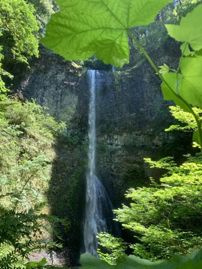
Silver Falls State Park is a double dose of photo bliss when it comes to Oregon photography locations! Not only does it contain beautiful landscape opportunities, but it is one of the best places in Oregon for portrait sessions.
Silver Falls contains 10 different waterfalls to photograph, including one with a walking path behind it, so you can photograph the back side of water. All our Disney fans will laugh at that reference, but even if you’ve never heard the joke, imagine the pristine beauty of cascading water. Then imagine walking behind the falling flow. That’s a unique perspective you don’t often see in travel or landscape photography.
Besides endless Oregon landscape photo ops, Silver Falls is an ideal place for portrait sessions. With the year-round green canopies, your portraits will have perfect lighting no matter the weather or sun position. The many falls also give a beautiful backdrop for any engagement or family photo.
As a travel photographer, one of my favorite things about Silver Falls is the fact that it is dog and horse friendly (on certain trails.) No portrait session is complete without photos with your favorite pup or pony.
Getting to Silver Falls State Park
Silver Falls State Park has many entrances, as it covers over 9,000 acres. The park is near Salem Oregon, but can be accessed from Highway 214, from the North or South entrance. The easiest way to access the waterfall portion of the park is to come through Aumsville, or Stayton, and follow Highway 214 until you see the entrance to the park, and signs for the various sections.
Best Time to Photograph Silver Falls State Park
Silver Falls State Park is unique in its Oregon photography location, in that it can be photographed any time of day. With the tree cover, the harsh midday sun is diffused, so your shots will not be overexposed. While the park, and waterfalls can be photographed any time of day, I have had better luck with midday summer photography at this location.
The diffused sun filtering through the leaves is perfect for landscape photography and portraits alike. In the past I have used a light reflector during portrait sessions in this area to fill in the gaps.
For landscape shots of the falls, try to avoid early morning as it can be a bit dark under the tree canopies and behind the falls during this time.
Wreck of the Peter Iredale- The Most Unique Oregon Photography Location on the Coast
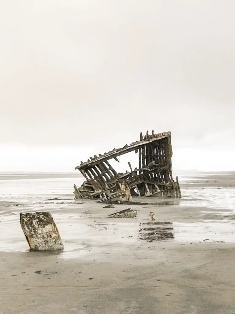
The decaying bones of the Peter Iredale shipwreck jutting through the crashing waves, makes for a perfect Oregon photography location. The metal frame of the ship is all that is left, but it is quite a sight.
The shipwreck makes for compelling photos at any time of day, but the really stunning shots are taken with the sun behind the ocean at sunset, or at high tide with the waves almost overtaking the ship’s bones.
Getting to the Wreck of the Peter Iredale
If this Oregon photography location is on your bucket list, don’t worry, it is very easy to find. First, you will want to navigate your way to the Fort Stevens State Park Campground area.
To get there, travel south on Highway 101 from Astoria, or North on Highway 101 from Seaside, and head into Warrenton and onto Columbia Beach Road. From here, the road turns into Ridge Road, you will then take a left onto Peter Iredale Road, at the sign for Fort Stevens Campground.
The road will dead end in the parking lot for the wreck. You will have to walk from here, but it is a short walk, and you will be able to see the wreck upon walking to the beach edge of the parking lot.
Best Time to Photograph the Wreck of the Peter Iredale
While you can get fun shots of the wreck at any time, the most breathtaking photos will be taken at sunset, with the sun setting behind the wreck. You will want to wait for a clear, cloud free, or mostly cloud free evening to obtain the best photographs.
McDowell Creek Falls- Waterfalls and a Nice Hike
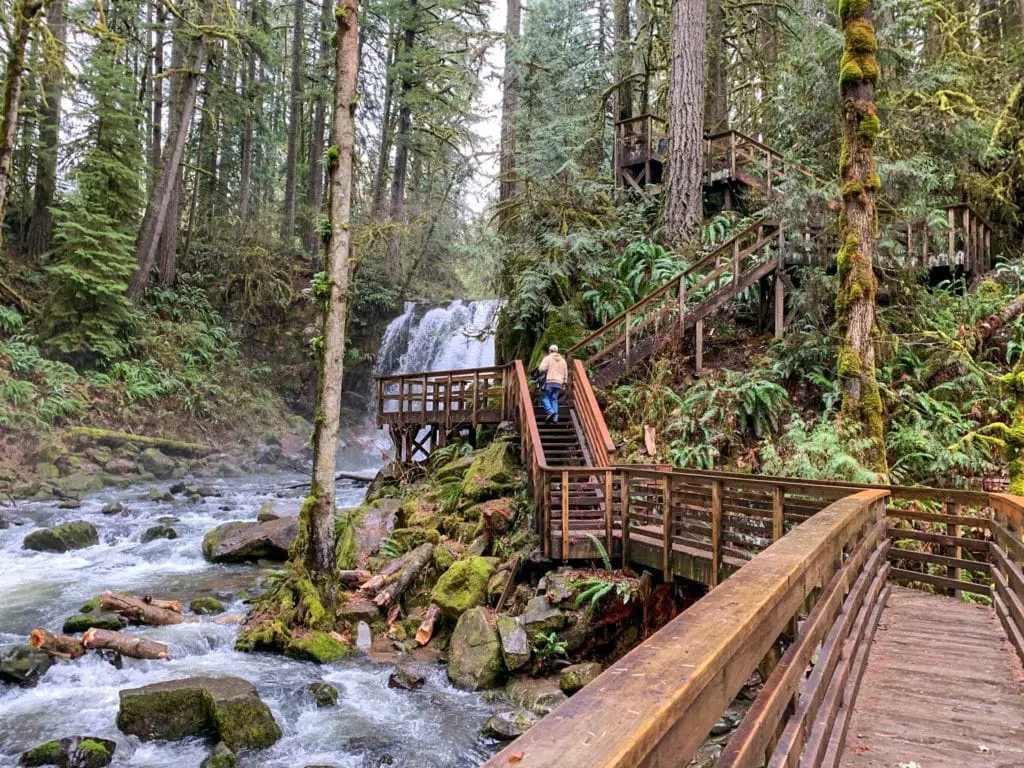
The McDowell Creek Falls hike not only offers travel photographers the chance to capture captivating shots of one waterfall, but two. If you’re not into hiking and lugging your gear, there is a parking lot at each fall.
The Royal Terrace Falls is 119 feet tall and has water cascading down terraced rock faces, surrounded by green ferns and trees.
The second falls of McDowell Creek are the most photographed. The Majestic Falls, while not even half the height of Royal Terrace Falls, is famous for its photogenic quality. Multi-tiered layers of wooden stairs contrast spectacularly against the foliage giving this area a mystical quality. As you walk up the stairs, the viewing platform puts you up close and personal with the falling water, giving you an ideal vantage to frame that perfect shot.
Between waterfalls, the stunning wooden and stone staircases, and the enchanting green moss, McDowell Creek is a beloved Oregon photography location, that will also help you get your steps in at the same time.
Getting to McDowell Creek
McDowell Creek has two parking lots, one at the lower Royal Terrace Falls, and one at the upper Majaestic Falls. The lower falls trailhead will be first, and you can find the second trailhead by following that same road, and looking on the opposite side for the next trailhead.
To get to the first trailhead at this Oregon photography location, you will first need to find Oregon route 20 from Sweet Home or Lebanon. Halfway between Lebanon and Sweet Home, you will turn onto Fairview Rd, (on the right if coming from Sweet Home, and on the left if coming from Lebanon.)
Then, take the next left onto McDowell Creek Dr, until you reach the trailheads.
Best Time to Photograph McDowell Creek
We have had the amazing opportunity to visit, and photograph McDowell Creek many times, and in multiple seasons. If you are looking for the falls to be flowing with large amounts of water, you will want to avoid photographing it in the summer, when water levels are much lower.
Our first visit was during winter, and the falls were easily seeing 4 times the water flow in February, versus our next visit in June. This is something to keep in mind if you plan to photograph this Oregon photography location.
As far as time of day goes, McDowell Creek is shaded by the large trees that surround each fall and the trails. This means you can easily photograph this location during any time of day. It is worth noting that Royal Terrace Falls does have less tree covering that Majestic Falls.
Thompson Mills- A Historical Oregon Photography Location
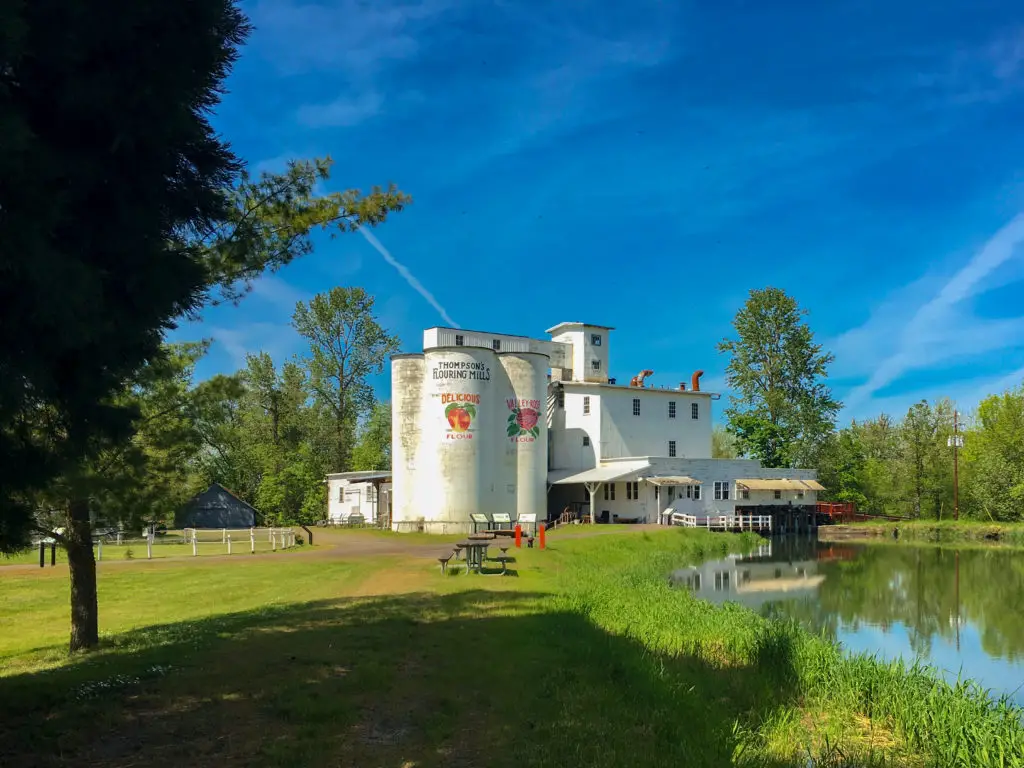
Thompson Mills may have its own fascinating history, but nowadays it is a historical museum to remind us of what used to be. Thompson Mills landscape photos ops are, without a doubt, some of the most unique and interesting I’ve ever shot. If you’ve never considered photographing old grain silos, think again.
If you’re forte is animal photography, this is a great location as well. When you first arrive, you will be greeted and surrounded by happy hens and ducks at the Mill Keepers house. Here you can get great photos of a historic home along with its friendly feathered residents.
The Mill itself is also stunning. With its bright white buildings standing out against a stark blue sky and a pictureesque pond in the foreground, the photos you take will certainly be frame worthy.
Additionally, if you are interested in antique machinery, the inside of the mill contains all the equipment from the mill’s operational time period. The lighting is tricky, but if you can get it right, these shots are really unique and amazing.
Getting to the Oregon Photography Location of Thompson Mills
Getting to Thompson Mills to visit this Oregon photography location is relatively easy. From I-5, take the Halsey exit, and turn West onto Highway 228. Once in Halsey, take a right after the train tracks, onto Highway 99 E.
Follow Highway 99 E into the tiny town of Shedd, Oregon. Take a right after the Shedd market, onto Boston Mill Rd. Follow the road until you see signs for the mill, then turn left into the parking lot.
Best Time to Photograph Thompson Mills
I have been to the mills 3 times now, and each time it was about midday. My photos turned out great with the white buildings against the blue sky behind it.
I would recommend visiting during the spring, when the sun is shining, and the grass is still green. As spring turns to summer, the sun may shine more, but the grass will brown.
I would also recommend attempting a sunrise photo of the mills. When facing the mills, the sun will rise behind them, creating the perfect landscape photo opportunity.
Painted Hills- John Day Oregon
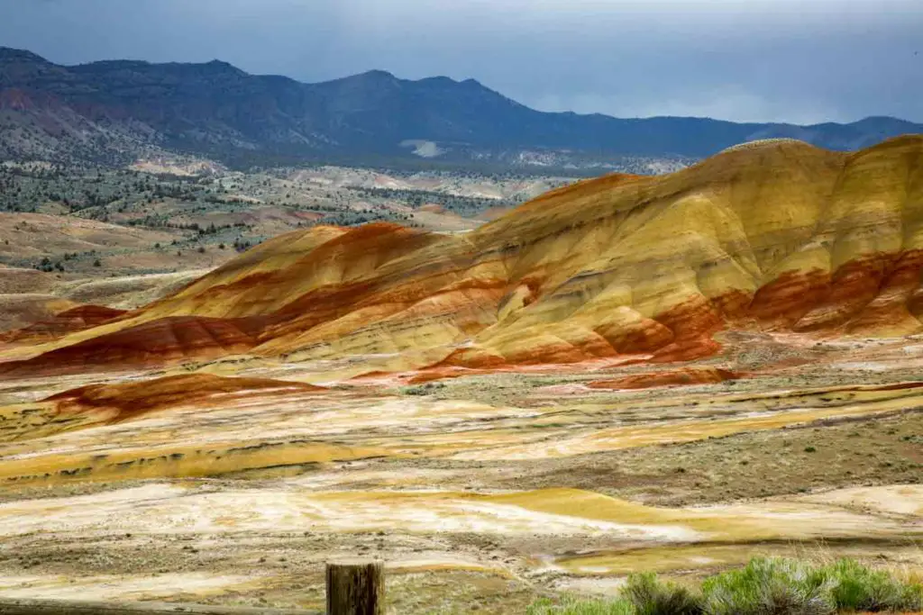
The Painted Hills are known nationwide for their beauty and distinctiveness. This Oregon photography location contains large mounded hills with streaks of orange, red, yellow and black running across them. The unique colors come from thousands of years of changes in the Earth’s surface, but all you need to know is…Wow!
Along many of the hills are boardwalks giving you a close-up view of the bright colors. Not too far from the Painted Hills, in the same park, are the fossil beds. Fossils are not allowed to be removed from the park, but you can certainly photograph them!
Getting to the Painted Hills Oregon Photography Location
The Painted Hills is an Oregon Photography location that can be a bit tricky to find. Expect to spend more time driving to this location, than you may spend at it. Also, be aware this area is remote, there are not any nearby restaurants or fuel stations, and you may encounter cattle on the road.
You will have to find your way to Highway 26 from Prineville or John Day. If coming from John Day, you will pass through Mitchell Oregon, which is the only nearby town.
From Prineville, you will travel about 44 miles on Highway 26 before turning left onto Burnt Ranch Rd/ Bridge Creek Rd. Follow this road for about 6 miles, then follow the signs to the park. This is the area where we have seen cattle and tumbleweeds in the past.
And as I told my father during our last adventure, do not run over the tumbleweeds. Because, they will get stuck on the bottom of your car, and you will drag it for miles.
Best Time to Photograph the Painted Hills
Planning the trip out to this Oregon photography location can be a chore, but it is worth it. If you are going through all that planning and driving, be sure to plan around the sun.
The park itself recommends the late afternoon, with the sun out as the best time to photograph the hills. During this time, the sun reflects perfectly off the hills, and exaggerates the contrasting colors.
Tokatee Falls
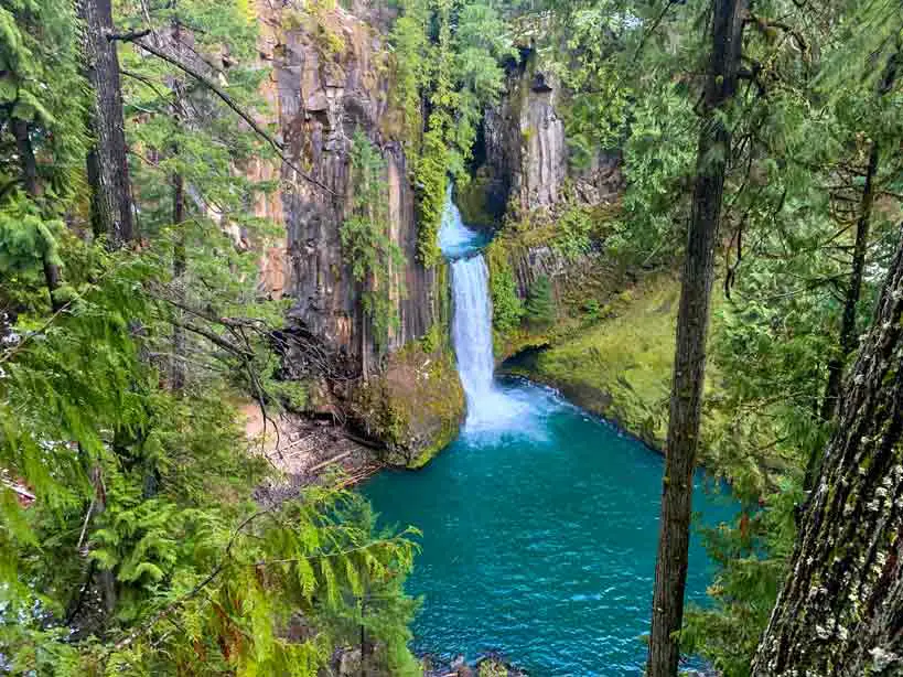
With crystal blue water pouring down two separate falls stacked on top of each other and collecting in blue pools at the bottom, Tokatee Falls is the ideal Oregon photography location. Moss covered rocks open up dramatically to let the falling water through, creating a beautiful contrast of colors. The hike to Tokatee Falls may be short, but it can be treacherous in winter, so secure your gear. Just leave one camera free to capture the many photo opportunities along the trail. Traveling the path is made easier and more photo-worthy with the addition of handmade stone staircases winding through tall old growth trees.
At the top of the trail is a beautiful view of the ravine down below with the blue water flowing between the tree tops. From what I’ve seen, some of the best views are at the base of the falls. However, there is no real path down, so you’ll be scrabbling down a very steep slope while worrying about expensive equipment. It you will likely find it best to stick to the viewing platform on this one.
Getting to Tokatee Falls
Tokatee Falls is in the heart of the Umpqua National Forest, and can only be accessed via Highway 138. Highway 138 departs from Roseburg Oregon on the west side, and connects to Highway 97 on the Eastern side. Highway 97 eventually makes its way north to La Pine, and south to Klamath Falls.
Tokatee Falls is near Clearwater, almost directly off of highway 138. There will be signs to tell you the falls are near, and to tell you where to turn off. The turn off is on the north side of the highway.
Best time to Photograph Tokatee Falls
The best time to photograph this Oregon photography location is in the spring or early summer. During the months of April to mid June, the water level will be higher, and the water will be a brighter blue.
Additionally, the best photos are taken when the sun is out, but before 9-10 am, as the harsh sun can wash out many details later in the day.
Fort Stevens State Park
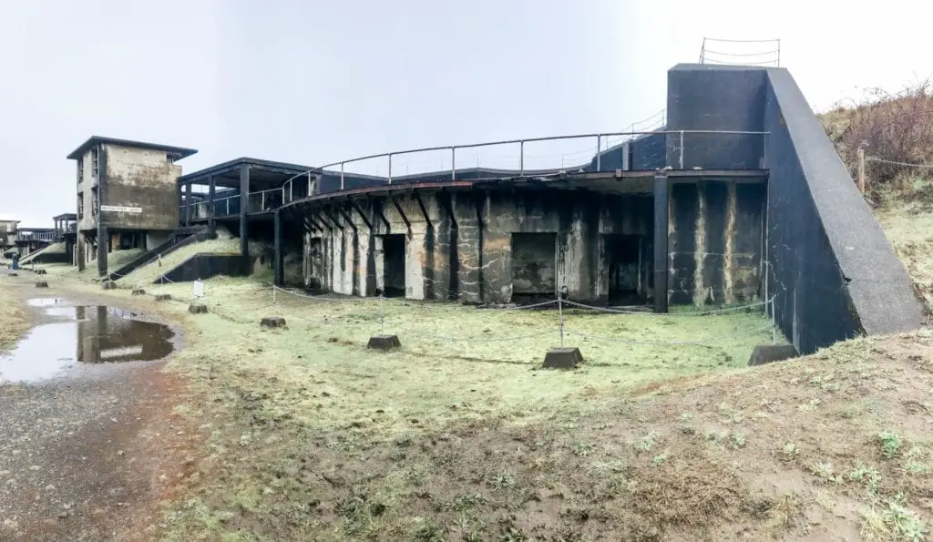
Abandoned buildings always hold a certain appeal for me, as they do for many travel photographers. Maybe it’s the mystery and sadness of so many beautiful places going to ruin, but one thing I know. Some hauntingly beautiful photo opportunities await.
Fort Stevens as a state park, is a little different. Many of the bunkers are dark, making it hard to get a good “abandoned” shot, but outside the colors are spectacular and put a whole new patina on abandoned. Elk herds also call the park home, so you’ll have the chance to photograph some wildlife as well as ships on the Columbia River.
Getting to Fort Stevens State Park
These directions are very similar to that of the Peter Iredale Wreck above. You will take Highway 101 until you reach the town of Warrenton, which is just south of Astoria.
Once in Warrenton, find Ridge Rd, which is the road nearest the ocean. Follow Ridge Rd all the way to the end, then follow signs to access the fort.
Best Time to Photograph Fort Stevens
If you are looking for elk in your photos, you have a better chance of seeing them first thing in the morning, or evening. We arrived before the park officially opened on a quiet foggy morning, and were able to capture unique and beautiful photos of the fort amongst a fog filled background, and with elk in the foreground. These gave the photos a slightly apocalyptic vibe.
If you are looking for a different vibe for your photos of this Oregon photography location, consider visiting at sunset, just the same as the Peter Iredale. During this time, the sun will be setting over the beach right behind the fort.
Smith Rock State Park: Adventure and the Perfect Oregon Photography Location
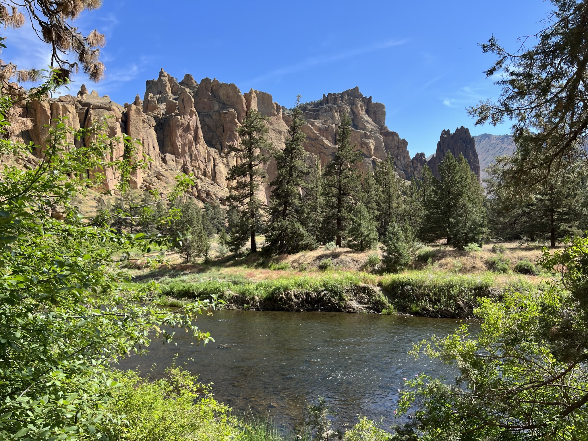
Smith Rock State Park is the perfect Oregon photography location. Giant mountainous rocks poke out of the Earth surrounded by green fields, creating a stark contrast, which really pops for photos.
Between the rock outcroppings, you will find a meandering river, full of otters, ducks, and more. The river winds through evergreen trees with rock cliffs towering high above.
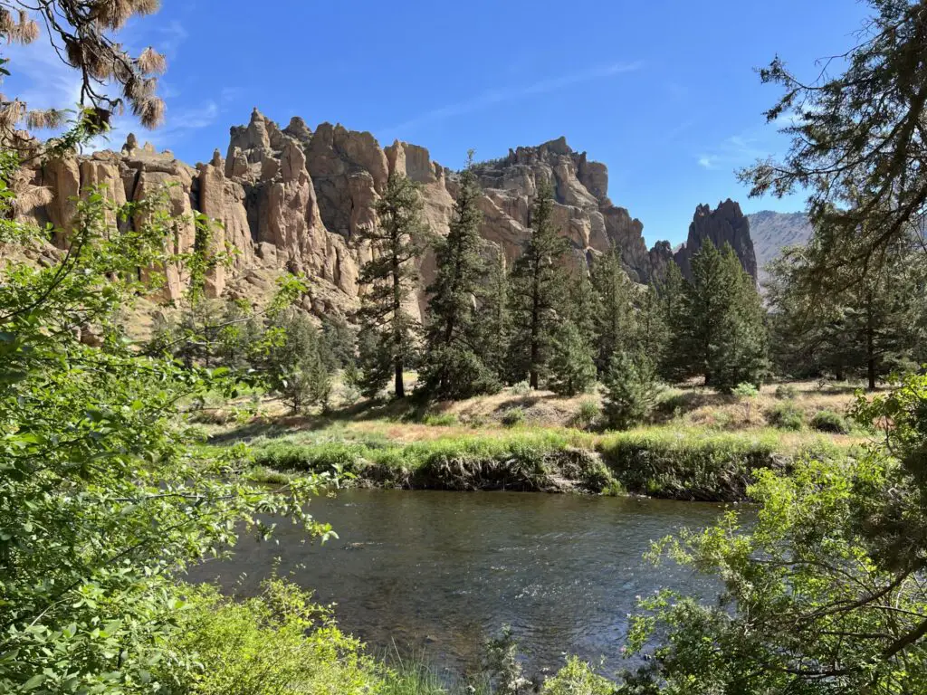
As you make your way through the bottom, or climb to the top, you will most likely see daredevils scaling the sides of the rock.
Smith Rock is the ideal hiking and Oregon photography location. So, when you set out on this journey, be sure to have lots of water, some good boots, and your camera full charged up.
Getting to Smith Rock State Park
Finding the amazing Oregon photography location of Smith Rock State park is relatively easy. From Redmond, take Highway 97 north to Terrebonne. Turn right onto Smith Rock way, then left onto Lambert Way. Do not follow Smith Rock way, it has a deceiving name.
Lambert Way will become NE Wilcox Ave. Follow this for about 2 miles until you see NE Crooked River DR, on the left. Follow this to the parking lots, which will be on your left.
Best Time to Photograph Smith Rock State Park
Smith Rock State Park is best photographed in the early morning or late afternoon, evening. During midday, hikers are plentiful, and will be in your photos. Additionally, the daytime sun is harsh in this area, and will wash out the tan colored rock walls and cliffs.
Multnomah Falls
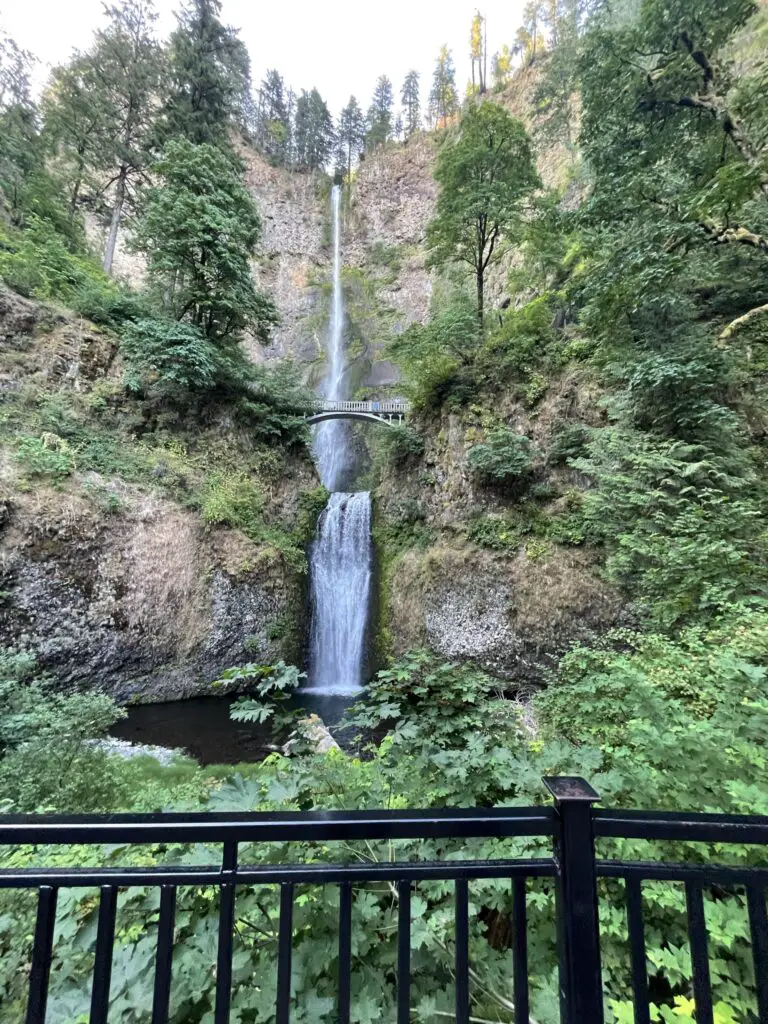
Multnomah Falls may be the most visited and famous Oregon photography location, but this doesn’t mean you should overlook it. There are still many stunning shots of the falls you can get, if you arrive early.
The falls with the bridge are the picture of perfection with it comes to composition. But, many people and photographers alike miss out on half the journey, and views.
If you are looking for a more unique vantage point of the falls to photograph, consider following the trail through the many switchbacks to the top of the falls. During the heart pumping journey, you will be rewarded with amazing views of the gorge from high above, as well as additional lookouts of the falls from lesser known angles.
Getting to Multnomah Falls
Multnomah Falls is in the Columbia River Gorge, located East of Bridal Veil and West of Dodson. The falls can be accessed from 1-84, or Highway 30. This location is extremely easy to find. You will see signs along both highways.
The parking lot off Highway 30 is much closer, but smaller. Spots are very limited here, and due to traffic, you will most likely be funneled down the highway and have to turn around to access it again.
During peak times, we recommend coming from I-84, and using the parking lot from that highway.
Best Time to Visit Multnomah Falls
We recommend you get to the falls as early as possible for a greater chance of getting photos without hoards of tourists in them. Crowds pick up as the day goes on. During our first visit to the falls, we arrived at 6 am, and while there were a few people milling about, we used a little patience and were able to get some amazing photographs.
During our next visit, we arrived about 3 pm, and had no chance of a waterfall photo without other visitors in it.
Sahalie Falls
I know, I know, another waterfall! Oregon is a state full of beautiful waterfalls , and we cannot get enough of them. Plus they are great Oregon photography locations, and Sahalie Falls is no exception.
Sahalie Falls is located in a dense Oregon forest, where the enticing smell of fresh dirt, and fir trees fill the air as the sound of roaring, rushing water fills your ears.
The fall can be accessed from above or below, with a relatively short walk, or you can explore the entire loop and access Sahalie Falls from the opposite side of the river, and then continue down river to Koosah Falls.
Sahalie Falls is flanked by tall, bright green topped fir trees, and the water flows like bright blue crystal in the spring and early summer.
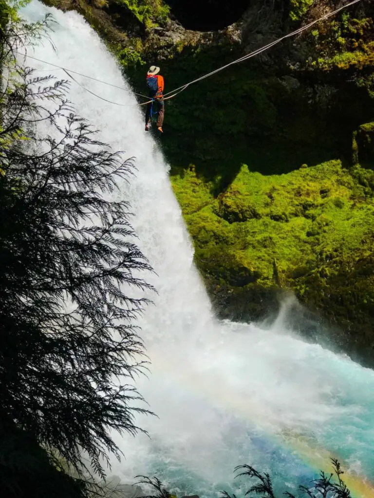
Besides the blue water contrasting the green landscapes, you may even find some additional subjects to photograph. Sahalie Falls is often used by slackliners to accomplish their heart stopping feats. During our first visit to the falls, we witnessed one slackliner hanging from a rope across the falls, enjoying a unique perspective.
When we had hiked to the other side of the river, a more daring slackliner was attempting to walk his way across the line. We watched for a bit, and photographed, as he walked, and dropped, and bounced his way back up to the top of the line.
Getting to Sahalie Falls
Sahalie Falls are located on the western side of Highway 126, just about a mile from Clear Lake. From Eugene, you will take Highway 126 East and then north until you arrive at the trailhead. From Corvallis, you will take Highway 20 East to Highway 126. From Sisters you will take Highway 20 west and then turn onto Highway 126 to get to this Oregon photography location.
Best Time to Photograph Sahalie Falls
The answer to this question is multi parted. The best time to photograph the Oregon photography location of Sahalie Falls is based on weather, time of year, and activity level.
If you are hoping to get some photos with the slackliners, they are more likely to be out during warm and sunny days, and more often on weekends.
For regular landscape photos, be sure to pick a sunny day, in spring or early fall when the water levels will be higher, and the water will be more blue. We photographed this location during peak sun, and we loved the sunlight reflecting off the blue water.

