Before going to Case Mountain, I never thought of hiking in Manchester Connecticut. Apparently, I was a member of a small minority unaware of Case Mountain’s history and splendid sites.
Case Mountain: New England Hiking, History and Cliff-Top Views
Fall color had been dim in Connecticut, the few years before my first trip to Case Mountain. We’d become accostomed to receiving autumn in fits and starts.
The maples were the first to go, blazing crimson and yellow. Others followed suit with trepidation, warding off the icy roar of winter winds with tenacity and forbearing.
In was in the midst of this slow crawl toward fall, when we were called to Case Mountain, a hike full of New England history. Although it was unlikely that we’d see a field of dazzling color, it’s never a bad time of year to explore a cliff-top overlook. So, we loaded Nemo, our Seconds to Go mascot, into the car and hit the highway.
I was silently wondering if he’d have much of an opportunity to stretch his legs and blow off some pent-up energy. Hiking in Manchester Connecticut? It never crossed my mind unless I planned to spend several hours slugging my way through retail heaven in the nearby malls.
Fortunately, Case Mountain is sitting peacefully in a time warp, protected from the march of progress by the healthy and hardy love New Englanders have for the past. As it turns out, it’s the perfect place for a hike, even if the foliage did let us down.
Entering Case Mountain Preserve
We came upon the preserve via the Case Pond lot off of Birch Mountain Street. Although the main entrance is on the other side of the acreage on Spring street, this approach was by design. Taking this route allowed us to skip down a lesser known path along Case Pond before picking up the well-traveled Carriage Road trail.
Yes, we were here to enjoy the hike and the mountain summit, but I admit to being a bit of a history buff, and Case Mountain intrigued me. Despite devouring two pages of an early morning Google search, I hadn’t picked up much about the Case Brothers who built the park.
They were a prominent family. That was evidenced by the large houses on Spring Street and the petition to include the area on the National Register of Historic Places, but I wanted to understand what would drive a man to create a large carriage park, not just for himself, but his fellow townsman.
To understand, it seems, you have to dig a little into the past.
The History of Case Mountain
By the late 1800s, the industrial revolution was in full swing. The railroad had been born and manufacturing was booming. As a result, a new leisure class was emerging, fueled by the wealth of industry. By some accounts, the late 1800s saw the birth of more than 4,000 millionaires in America.
These families joined the ranks of the uber-wealthy Astors and Vanderbilts. They erected palace monuments to recreation on Newport, Rhode Island and created vast city parks to escape the grime of daily city living.
The industrial revolution was also a boon to carriage manufacturers. Not only did the emerging wealthy class demand more vehicles, upgrades in manufacturing made it easier for carriage makers to create the extravagant horse-drawn vehicles those of wealth demanded.
Because carriages were a status symbol of the time, it was important to be seen when driving. For that reason, inner-city parks were transcribed with a system of carriage roadways where the wealthy could promenade in style.
By the late nineteenth century, mass production of a light, two-wheeled buggy brought daily horse-drawn transportation into the hands of the masses. The average non-farm employee of the day may have only earned a slight $483 a year, but it was now possible to purchase a carriage for as little as $20 through a mail order catalog.
With this advancement, the pleasures of the leisure set had trickled down to the masses, and in Manchester, local mill owner Alfred Case began constructing his own carriage paths around the mountain property across from his home on Spring Street.
Park construction was later finished by Case’s son and, to the delight of townspeople, was open to public use. According to the 1923 book “History of Manchester”, the Cases “performed a notable publick service” by “preserving
the natural beauty of this tract and making it accessible to the townspeople”.
Setting Out Across Modern-Day Case Mountain – Exploring the Trail System
While the industrial revolution has given sway to more modern means of transportation, the old carriage roads remain on Case Mountain. It’s a testament to time and the perpetual state of progress of man.
To follow the old carriage trail, my map indicated that our course would veer from the parking lot off Birch Mountain Road toward the water on an undeveloped path. It was narrow and marshy to start, but soon joined the Carriage Path proper, a wide open trail with densely packed footing and easy hiking.
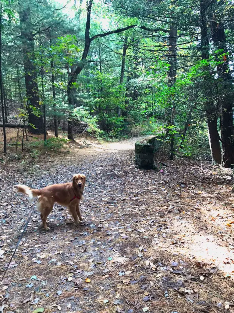
From here, Nemo could smell the water, so he made frequent darts toward the woodland. Fortunately, Case Pond, though nearby, was not yet in site.
It wasn’t long before we picked up the first stone wall at the edge of the upper marshland. We traveled with it for awhile before the Carriage Path turned left and headed toward the backside of Case Mountain Summit.
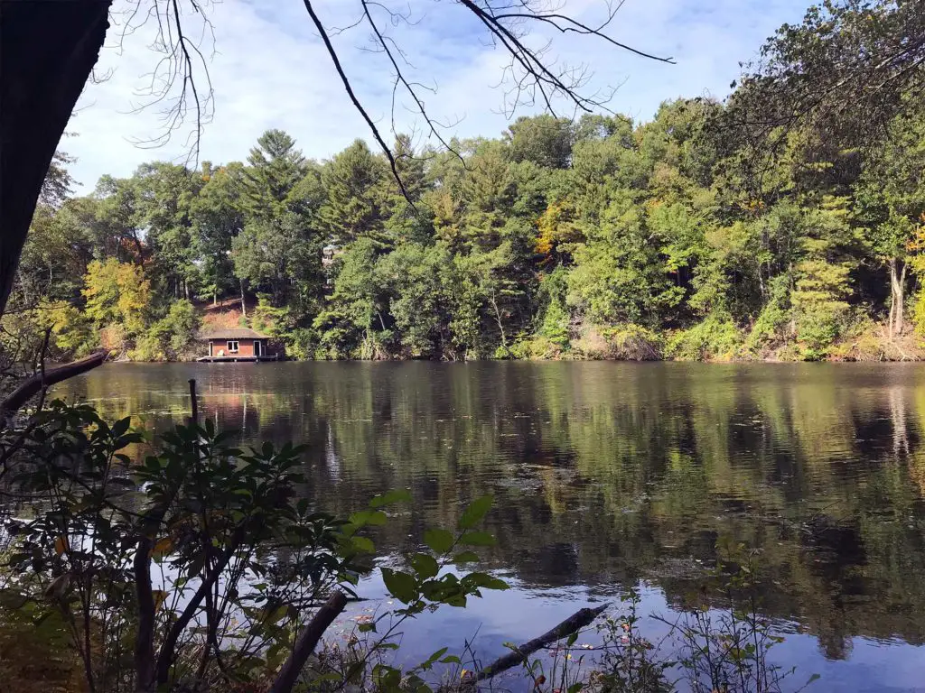
Instead of following the wider, more traveled path, we picked up a smaller trail, hiking along the water’s edge for several yards. Across the pond, we caught glimpses of the historic Maytie Case Crowell bathhouse before trekking away from the water and into the woods.
A slight uphill climb brought us to the overgrown and abandoned Carol Maude Case Dennison cabin. According to the petition to put Case Mountain and its surrounding properties on the National Register of Historic Places, the two-story building was erected in 1918 as a summer retreat and is considered a rustic-style log chalet.
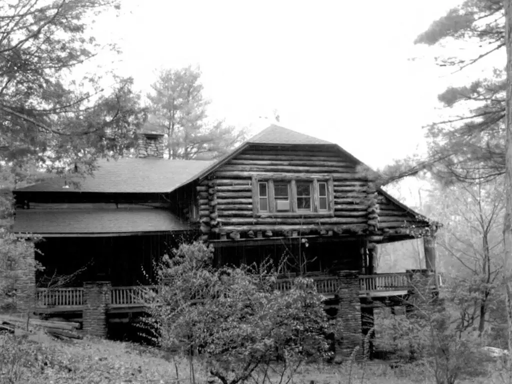
Courtesy of National Register of Historic Places Registration Form
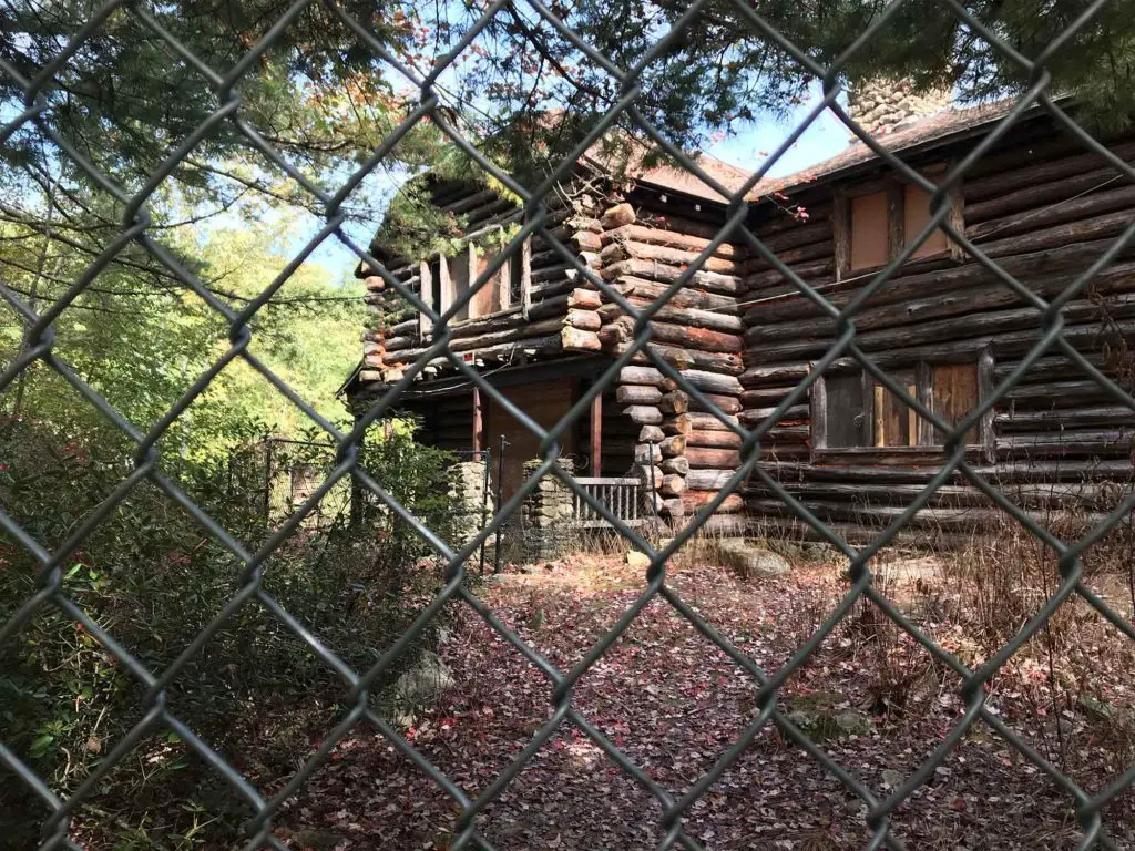
The cabin took the starring role in a 2014 film, “The Animal”, pitting veteran teen actors, Lauren Keyana “Keke” Palmer and Elizabeth Fillies against a mysterious woodland beast. Despite the building’s celebrity status, vandals continued to plague the cabin post production until a stout chain link fence was erected to keep out the curious.
Unable to get near it for a closer look, we circled the perimeter, taking a few pictures and discussing the construction of the cabin, before deciding to continue with our hike. Things got a little confusing here, with several possible pathways leading into the woods, but rounding to the back of the cabin and keeping the water to our right, we picked up the trail again easily enough.
Getting Back on the Case Mountain Carriage Trail
Case Mountain is a peculiar time-traveling experience. Falling prey to the impact of the passing years and erosion one minute, it revives in the next mile with stone walls and abutments as strong as the day they were erected.
We experienced this as we left the sad state of the abandoned lodge and traveled up the carriage access path, over crushed stone and the leaf-strewn litter of our colorless fall. We made a brief splash up against the pond where time stopped and the path ambled upward, accompanied by a stout stone wall guarding the precipice.
Down the hill, we could see the water through the trees, and what appeared to be the remains of a broken dam, reminding us that time always moves onward, sometimes with devastating effects.
We again witnessed the ravages of time as the grade became steeper. That’s when the pristine gravel path began to decay, and we were forced to ford erosion tunnels, some a foot deep or more.
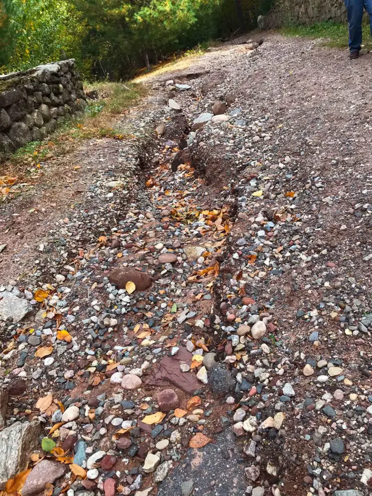
At last we reached the top of the rise. Here, a set of stone stairs led up a hill to nowhere before our trail rounded the bend and intersected the Carriage Path once again. This is the true entrance to Case Mountain.
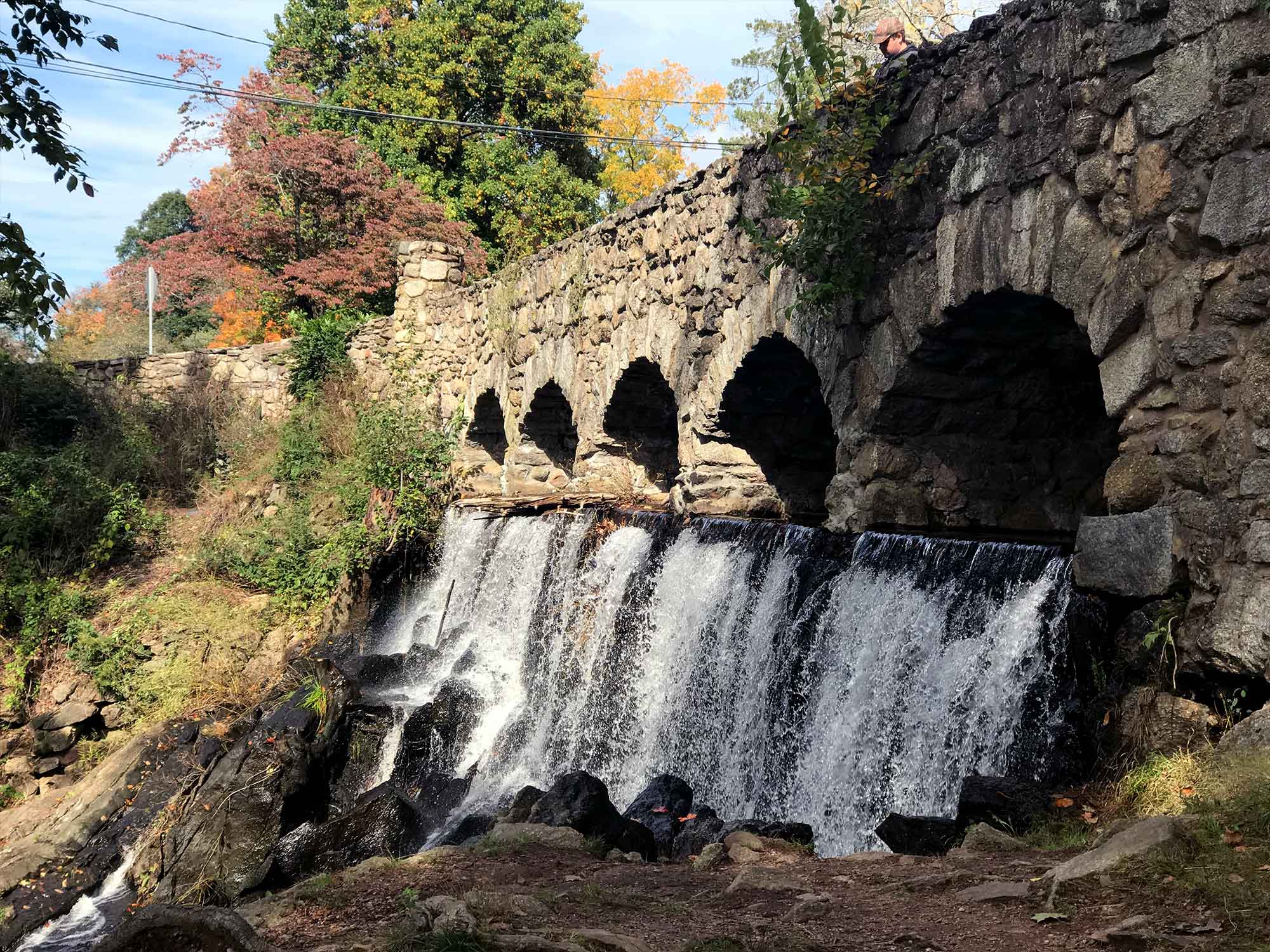
To move carriages in and out of the park, Alfred Case constructed a stone bridge over the Lower Case Pond Dam. The primary parking area is located near here on the east side of Spring Street where one of the Case Brothers’ mill properties still sits today.
Most foot traffic enters over the bridge or up the stone staircase from beneath the falls and hikes up the carriage drive. Since we started our trail on top opposite side of the park, we had to detour slightly to see the bridge and waterfall, a side trip well worth the effort.
Hiking the Carriage Road to the Summit of Case Mountain Preserve
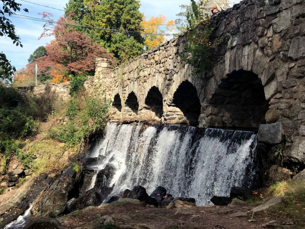
The detour also allowed us to cross over the bridge and pick up the Carriage Trail, taking a similar approach to the early townspeople who enjoyed the park.
Because it was made for vehicle travel, this part of the trail was wide and flanked by stone walls. It was easy to imagine the journey inside an open carriage and how pleasant it would be to spend an afternoon traveling through the woods.
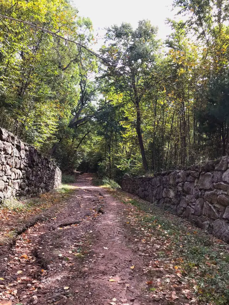
Multiple pathways now crisscross this part of the park. We decided to leave the Carriage Trail and jump onto the pink trail. Still heading south to the summit, we hoped to pick up on more of the history of the park. Unfortunately, the approximate half mile to the top is relatively uneventful.
However, what it lacks in historical sites is made up by the sheer solitude found in this part of Case Mountain Preserve. The only other person we saw on the trail was bent and inspecting logs and rock crevices, indicating that this is a great side excursion for exploring nature. If that isn’t your interest, I’d recommend remaining on the white-marked carriage trail for your ascent to the 744-foot summit
Reaching the Summit of Case Mountain and Beyond
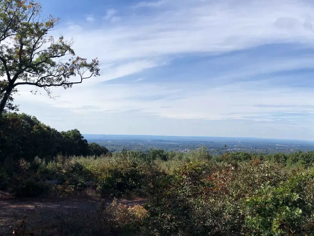
Even in the absence of foliage, the Lookout Mountain Summit on Case Mountain Preserve provided a satisfying view of the valley. On a clear day, it’s rumored that Heublein Tower in Simsbury is visible, but a light haze across the horizon prevented us from seeing that far.
Most people hiking within the park seek out the summit, so it’s busy at the top. We were joined by mountain bikers, other hikers and a few dogs as we snapped photos and pointed out recognizable landmarks.
From the summit we took a side trip down the white/gray trail to “the chimney” remains of an old boy scout camp. The trail from here continues onward into an old girl scout camp, but we turned back and rejoined the Carriage Path, initiating a return trip toward the Birch Mountain parking lot.
A portion of the Shenipsit Trail also runs through this section of the preserve. It enters the property from Birch Mountain Road and parallels a large portion of the Carriage Path heading south.
It then crosses the Birch Mountain Summit before exiting the Case Mountain property toward Gay City State Park. We had intended to pick this up where it intersected the Carriage Path shortly after the summit. The map shows a rock ledge on the yellow trail that we also wanted to take a look at, but we ran out of time.
That was our biggest lesson about visiting Case Mountain Preserve: you need plenty of time. The trail system is vast with a number of intersting sites of interest, so plan on several hours if you want to criss-cross the many pathways.
Snapshot of The Trails of Case Mountain Preserve
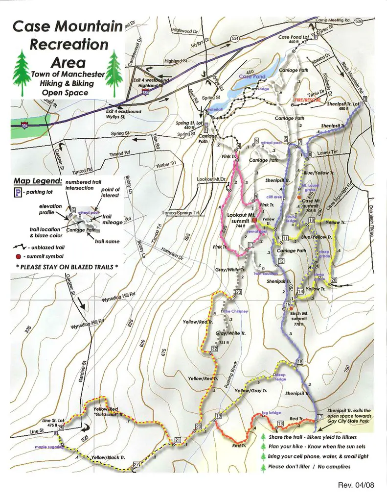
Be aware that there are 8 different trails covering the Case Mountain Preserve. The shortest covers just over a mile and a half of ground while combining the many different trails and loops could extend your hike to over 11 miles. You’ll cover vertical miles as well, climbing as much as 1500 feet in elevation.
To help you find the best trails for your adventure, here is an overview of 3 of the more popular Case Mountain Preserve trails and loops:
Highland Trail/Pink Trail to the Lookout Summit Loop
Trail Type: Loop
To reach the Pink Trail, you’ll need to park at the Spring Street lot and enter the preserve by crossing the old waterfall dam. From here, you’ll pick up a portion of the old carriage trail heading south before it merges into the Pink Trail. If you take the entire loop, you can plan on trekking around 4 miles. Plan on 2 hours from start to finish. This is the best trail for reaching the Case Mountain Preserve summit with views of Hartford and beyond.
White Blaze – Carriage Path
Trail Type: Loop
The carriage paths remain one of the most visited hikes within the Case Mountain Preserve, and it’s easy to understand why. Wide open pathways, stone walls and a trip through history, it’s everything good in a New England hike. For that reason, the White Blazed Carriage Path remains one of the most popular within the preserve.
Similar to a trip on the Pink Trail, you’ll reach the summit on the White Blaze, but you’ll see more of the carriage path and preserve, while enjoying a visit to Dennison Lodge (mentioned above). You’ll also catch a glimpse of the pond and can detour a bit if you want a more comprehensive view.
The White Blaze is around 3 miles long, but does cover some interesting terrain, so give yourself a couple of hours.
You can pick up this trail head from the Case Pond Lot on Birch Mountain Road.
Birch Mountain/Yellow Blue Trail
Trail Type: Out and Back
Accessible from both the Shenipsit and Lookout Mountain Trails, the Birch Mountain trail offers a challenging trek through rugged terrain, including a vast Mountain Laurel grove and unique rock formations.
While the summit and overlook within the preserve often get credit for being The Case Mountain, the peak actually bearing that name lies within the path of the Birch Mountain trail. In fact, you’ll ascend the mountain during your trek, and though the trail does not provide any summit views, the Birch Mountain Trail is a challenging hike for anyone looking seeking a more competitive adventure combined with some of Connecticut’s wonders.
The best way to reach this trail is to park in the Line Lot and set out on the Yellow/Black blazed trail. This quickly becomes the Birch Mountain Trail
Visiting Case Mountain, Where to Park
When visiting Case Mountain, you’ll find 4 main areas for parking. Your best bet is to choose the one closest to your trailhead and set out from there.
Parking: Four options:
- Case Pond Lot – 68 Birch Mountain Rd, Manchester, CT
- Spring St. Lot – 670 Spring St, Manchester, CT
- Shenipsit Trail Lot – Near 148 Birch Mountain Rd, Manchester, CT
- Line St. Lot – Line St, Manchester, CT
Tips for Hiking Case Mountain Preserve and Visiting Manchester
Despite the lack of foliage, our visit to Case Mountain was a satisfying success, providing a small glimpse into how people lived and worked in a bygone era. If you enter the park the way that we did, it’s worth taking a little detour over to Spring Street to see the Case Brothers mill and the houses where they lived.
If you’re interested in exploring the history of the Case Brothers and the mountain preserve they created for the townspeople of Manchester to enjoy, there are a few online sources you can look up. The most in-depth information that I found regarding the history of the Case Brothers and the historic Highland Park area, came from the Manchester Historical Society. The application that was submitted to the National Historic Register also contains some interesting tid-bits about the houses and the park.
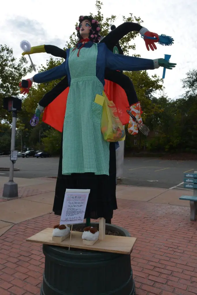
To extend your trip, consider visiting nearby Gay City State Park and some archeological ruins or cruising through downtown Manchester. The latter is particularly fun in the fall when the annual scarecrow festival takes place. In the past, 30 business locations have hosted handmade scarecrows created by local individuals, schools, civic groups and town staff.
LOCATION
Manchester, CT
TRIP LENGTH
2-8 hours
THINGS TO DO NEARBY
Duck Pin Bowling– 23 minutes away
Ray of Light Farm– 45 minutes away
Gillette Castle– 50 minutes away
Rock House Reservation– 1 hour away

