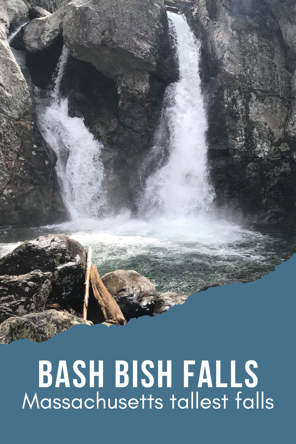
Bash Bish Falls State Park is home to the Massachusett’s highest, single-drop waterfall. It’s a great day trip destination in New England, but is considered by some to be the state’s most dangerous as well.
Table of Contents
Bash Bish Falls State Park and the Massachusetts Versus New York Dilemma
Forty-five and sunny isn’t the best spring break forecast, but in New England, you take what you can get in early April. If the sun is shining and the wind isn’t blowing, it’s actually great weather for a hike. Spring is also a great time for waterfalls in New England. Northern snow melt plus early rains usually result in a torrential flow, as was the case at Bash Bish Falls State Park during our visit.
Bash Bish Falls State Park contentedly straddles the Massachusetts and New York state borders. From Massachusett’s perspective, Bash Bish is the highest single drop fall in the state where it sits serenely nestled in the Mount Washington State Forest.

As for New York, it’s hard for them to really lay claim to the falls since the actual land resides in Massachusetts, but you can pick up a much easier trail into Bash Bish Falls State Park from this side of the border. Simply park in the lot and enjoy a leisurely 2/3 mile stroll down the wide level path.
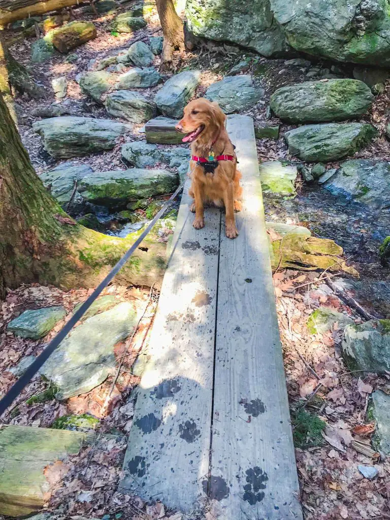
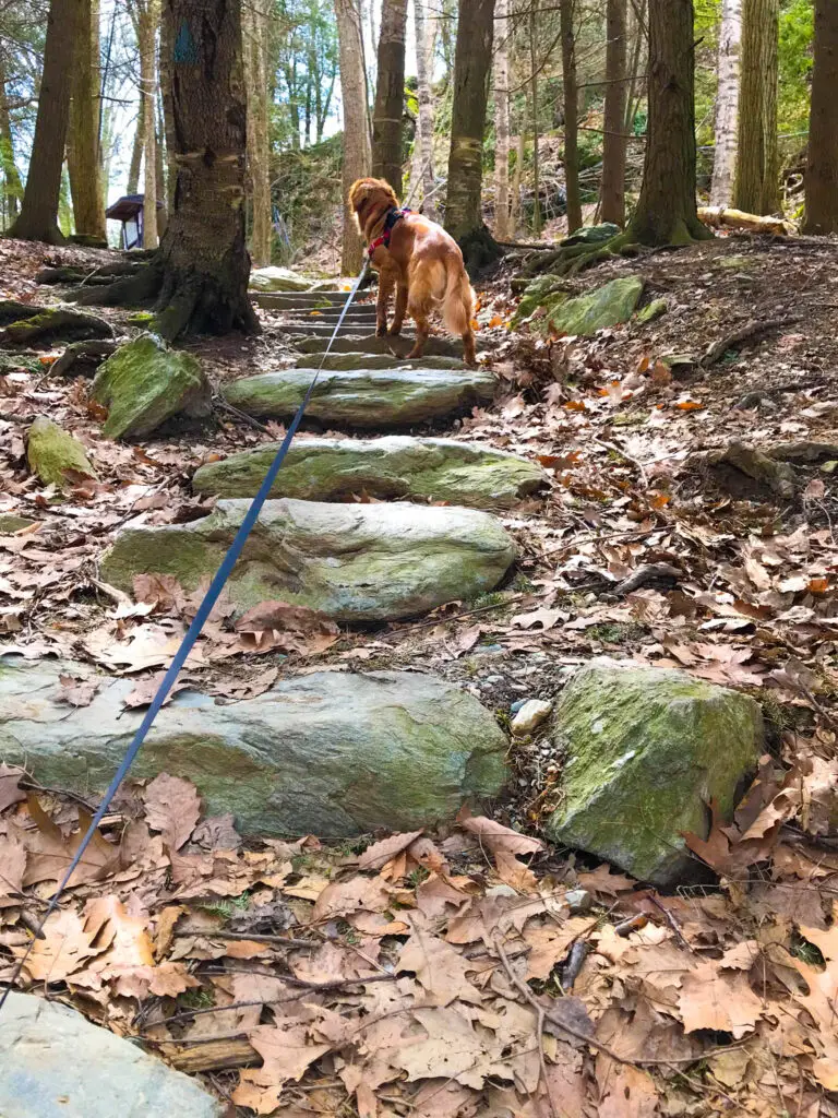
On our early April adventure, we opted for the Massachusetts trailhead. This route provided a slightly challenging, downhill wander through the Mount Washington forest. We hopped over rocks and crossed a trickling brook on a neat 1/3 mile hike that ended at a flat overlook across from the falls.
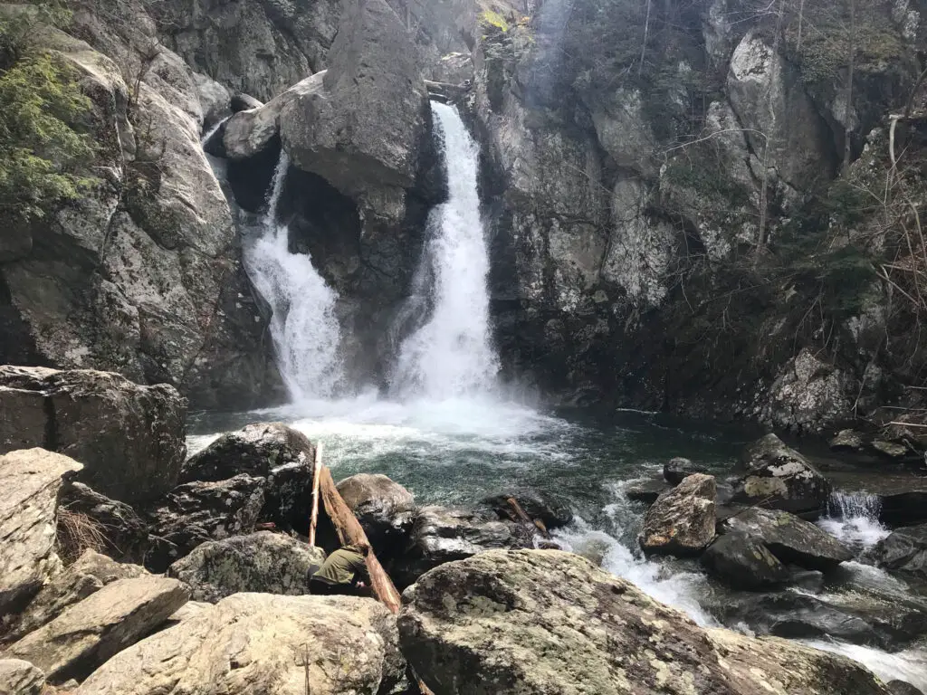
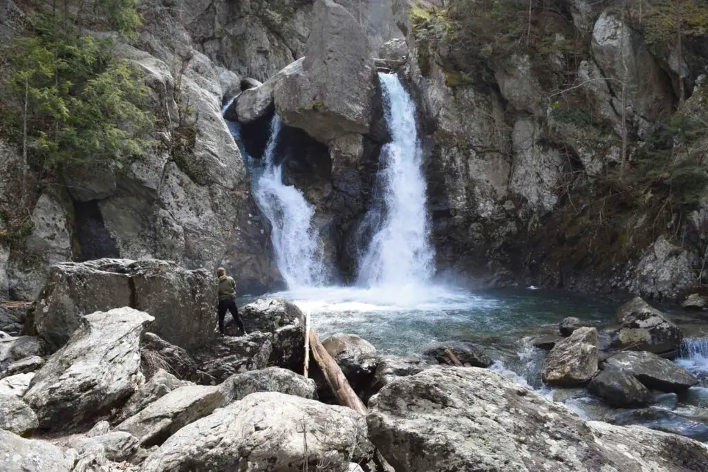
This is where the New York and Massachussetts paths converge, at the precipice of several flights of stairs that lead to the rocky base of Bash Bish Falls. April rains had resulted in a rapid and dangerous flow, but flat rocks at the base of the falls provided a nice resting spot.
It’s been reported that barricades have been erected during summer months at the top of the stairs leading to the falls, as post-pandemic traffic to the spot swelled to epedemic proportions and unruly behvior abounded. As a result, you may or may not be able to reach the base of the falls during your visit. Fortunately, there are still many prime viewing areas from above.
During warmer weather months, particularly on weekends, the falls are crowded. It’s not uncommon for police to be present to ensure the safety of visitors.
On an early April day, however, we nearly had Bash Bish Falls State Park to ourselves. Not only did the solitude make it easier to view the falls, but it also gave us a chance to rest for what came next…the hike back up to the parking lot.
While the trail down was challenging in that it required some precise footing over rocks and spring trickles, the journey back up required much more in the way of muscle power. Just remember that when you’re expending energy exploring the base of the falls.
Knowledge Is Power, Respecting the Dangers of Bash Bish Falls State Park
State parks in New England are no longer what they used to be in simpler times. As the internet and sites like this one expand the public’s awareness of lesser known locations, the number of visitors to destinations is on the rise.
While tourism is a good thing and residents should be encouraged to enjoy the bounties of nature when looking for things to do in Massachusetts, or anywhere in New England, common sense safety isn’t always on the minds of many travelers. As a result, accidents have become more common.
The dangers of Bash Bish Falls State Park is well documented and may even be responsible for its odd name. Rumor has it that Bash Bish was the name of a Native American princess who lost her life in a canoe that tipped over the top of the falls. This is an area of the park that has been a concern for decades. In 1973, the state Department of Environmental Protection installed a steel cable fence at the top of the falls to help prevent hikers from slipping and falling.
Despite the dangers, signs remain at the trailhead parking lot signaling the climb to the top of the falls. Little warned about past calamities (I should have done more research), we opted to take the trail after being promised a view into the river gorge from a blogger report. I use the word “trail” lightly as it is little marked, has no visible path and requires some real rock scrambling to make the ascent.
My gymnast daughter found the climb fairly easy, as did our goat-like Golden Retriever, Seconds to Go mascot Nemo, for whom it was a literal hop, skip and jump. I, on the other hand, relied on both hands and feet in some spots to balance myself and make the upward climb, but the view from the top is worth it. While it’s impossible to see the falls themselves or the river from the Stonehenge like promontory, you are rewarded with the vista of far-off mountains for your trouble.
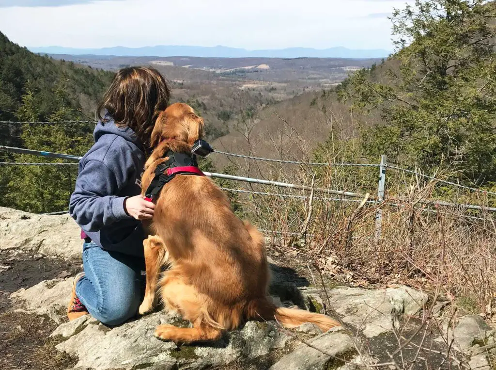
At one point, visitors to the Bash Bish Falls overlook were able to transcend a small stairway to what appeared to be a nice walkway with a view into the river gorge below. “No trespassing” and “police take notice” signs now make this a hearty gamble. If you have doubts as to whether the trail is closed due to insufficient upkeep or whether there were too many slips and falls, just take a look at the condition of the stairs to decide. We chose not to risk it, considering warnings from the Mass.gov website warning hikers to stay out of the gorge.
Being Safe at Bash Bish Falls State Park
The waters of Bash Bish Falls begin somewhere deep in the Mount Washington Forest where an underground stream rises above ground. As the water accumulates, it starts a downhill descent that travels over a series of cascades, plunging nearly 200 feet in the course of its journey. The water then falls 60 feet into the pool at the base of Bash Bish Falls, before continuing its descent into the Taconic Mountains of New York State. Bash Bish Falls State Park is surrounded by the Mount Washington state forest in Massachusetts and the Taconic State Park in New York. The location is remote and requires travel on a dirt road when approaching from the Massachusetts side. For an easier journey, consider taking a more roundabout route to access the falls from the New York side.
Bash Bish Falls State Park Trails
While the Mt. Washington State Forest offers 30 miles of trails, you’ll find only a few that lead to Bash Bish State Park in Massachusetts. The two primary trails take flight from the Massachusetts trailhead, while the third meandering trails sets off from the New York parking lot.
Introductory Hike
Length: .7 miles round trip
Difficulty: moderate
Beginning at the parking lot on Falls Road in Massachusetts, the blue blazed trail leads up, down and over rocks and stream trickles as you make your way to the base of the falls.
This is the official hike listed with the Massachusetts State Parks website for Bash Bish Falls, and the first hike mentioned in the narrative above.
Uphill Scenic View
Difficulty: Difficult
While not a trail listed on the state park trail guide for Bash Bish, there is a sign in the lot directing visitors to the spot. It’s less a trail and more of a rock climb, but it will lead to the top of the falls. From here, you can spot the nearby mountain peaks, but you will not have a view from the falls. We discuss this trail in the narrative above.
Hike from New York Parking Lot
This is less a hike and more a pleasant riverside stroll on a wide gravel path, but it is a pleasant way to reach the base of the falls.
Winter Hiking at Bash Bish Falls State Park
If you’re heading out to Bash Bish Falls in the winter months, it’s worth noting that the New York parking lot is closed during colder weather. However, you can still walk it by parking a mile down the road at the Taconic State Park and beginning your trek with a 1-mile stroll down Falls Road.
Where to find the Bash Bish Falls NY Parking Lot
Since the easier path into Bash Bish Falls originates on the New York state side of the park, many visitors begin their trek there. The Bash Bish Falls NY parking lot is located on Falls Road (State Route 344) in Copake, New York.
If you’re traveling with in New York from either the North or the South, take State Route 22 to the junction with SR 334. Head east, past Taconic State Park. You’ll see the signs.
If you’re traveling from points east and want to take the shorter, flatter stroll to the side, head west on Falls Road past the Massachusetts trailhead. The New York lot for Bash Bish Falls is a mile down on the left.
Bash Bish Falls Parking in Massachusetts
Lat/Long: 42.115025, -73.491629
Reach the Massachusetts trailhead for Bash Bish falls will take some navigation skills. While the trailhead is easy to find on Falls Road, it’s a back road trek to get to this point.
Most visitors will make their way to State route 41, where a turn onto Mt. Washington Road will start your journey into the Mt. Washington Forest.
Remain on Mt. Washington Road for about 12.5 miles. At the T intersection with East and West Streets, take a right onto West Street and then a quick jog south to remain on the road. Keep your eyes open for a peculiar switchback where West Street continues around the bend, but Falls right takes a more immediate right. Keep to Falls Road until you see the signs for Bash Bish Falls.
Bash Bish Falls State Park Photos
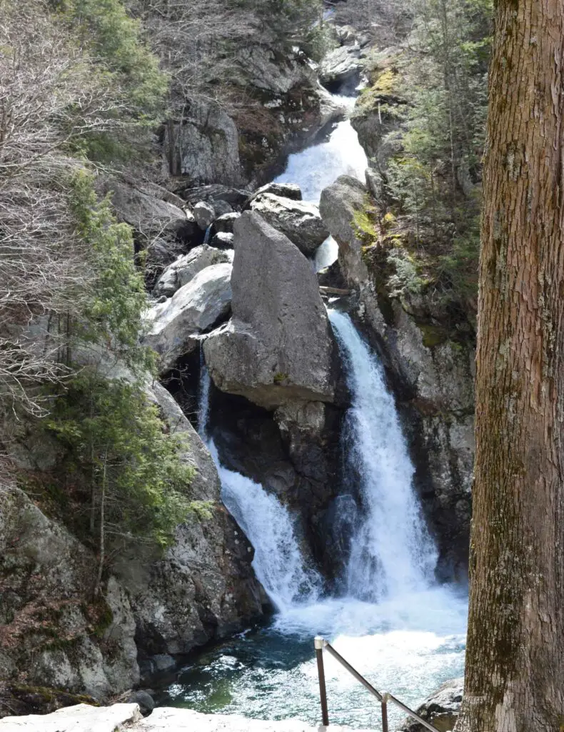
Swimming at Bash Bish Falls State Park
Swimming is prohibited in both the gorge above the falls as well as the pool at the base. Many visitors have been injured or lost their lives as a result of slipping on the rocks around the falls, so always observe caution.
Bash Bish Falls is a wonderful, remote destination on the western border of Massachusetts, but some common-sense safety smarts are important when making a visit.
LOCATION
Mount Washington Forest, Massachusetts
TRIP LENGTH
2-4 hours
THINGS TO DO NEARBY
Dads Diner- 8 minutes away
Copake Iron Works- 5 minutes away

