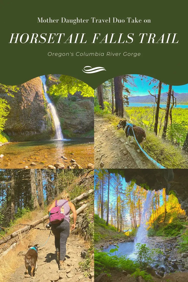
A recent trip to the Columbia River Gorge had us—as it does many—chasing waterfalls, most notably Horsetail Falls Oregon and the nearby Ponytail Falls, also known as Upper Horsetail Falls. This duo of plunging cascades offers everything for travelers of all abilities, from the view-it-from-the-roadside sort to the more avid hiker.
If you haven’t traveled Oregon’s Historic Columbia River Highway, then a short history lesson is in order. The Columbia River Highway is an historic marvel, built around the turn of the last century as travel by car was just beginning to strike the American fancy.
The scenic byway wound its course from Portland to The Dalles, traversing some of the most stunning vistas in the state while making its way along the river. While the roadway was an engineering wonder for its time, it proved no match for modern automobiles and was later replaced by Interstate 84. However, portions of the historic highway remain, revealing some of Oregon’s most out-in-the-open secrets.
Known for a series of cascades and the proximity of many adventures to Portland, the regional highlights do see a lot of visitors. However, it would be a mistake to let the popularity of the area keep you away. We found the historic portion of the Columbia River Highway to be fairly lightly traveled, and with a little planning, you can enjoy some of the best sights in relative solitude.
Is Horsetail Falls Oregon Open?
Due to recent wildfires and the resulting impacts, one of the most common questions is whether Horsetail Falls is open. In a word, yes. More importantly, of the two falls, it is the one most likely to remain open. While really not considered an Oregon hiking trail, a stop at Horsetail Falls can be combined with a jaunt up to Ponytail Falls to create a trek taking in two plunges.
How Long is the Oregon Horsetail Falls Hike?
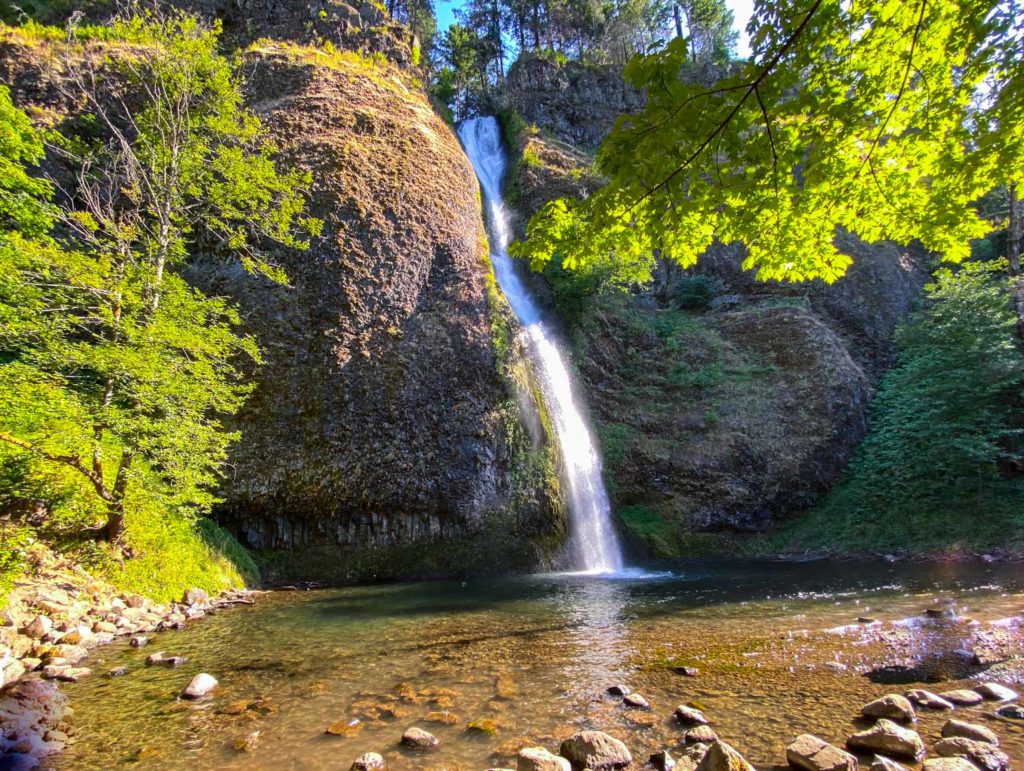
If you’re the type of traveler who prefers to view the scenic wonders of the world without the effort of a long and strenuous hike, then Horsetail Falls in Oregon is for you. The 176-foot plunge over a basalt cliff offers a geological glimpse into the state’s evolutionary history spruced up with some stunning scenery. Best of all, you’ll only need to walk a matter of feet to reach the viewing area.
If you’re traveling east on the historic highway, you’ll find parking on the left. Leave your car here and cross the road. Step onto a paved walk and follow it a short distance to the stone semicircle. At this point, you’re at the Horsetail Falls viewpoint.
From this vantage, you’ll get a sidelong view of the falls and the plunge pool below. During our late evening visit, most people found this inadequate and had walked down the stairway to reach the water’s edge. Many were wading into the plunge pool for cooling relief from the heat.
While we didn’t do much wading, we did step down to the water’s edge for a better view of the falls. However, if you’re content with what you see from the upper viewpoint, there is no need to walk farther.
Many of the stone walls here were built in 1940 as construction of the historic highway ploughed eastward. The viewpoint makes it easy to see Horsetail Falls, so most people are content to stay there. If you’re like us and always wondering what’s around the next bend, you won’t be satisfied until you’ve made your way up to Ponytail Falls or Oregon’s Upper Horsetail Falls as some have been known to call it.

Horsetail Falls Oregon and Beyond
While a visit to Horsetail Falls Oregon should be a definite stop when exploring the Historic Columbia River Highway, you can reach the more private Ponytail Falls with a little effort. The interpretive sign near the viewpoint for Horsetail Falls indicates that the uphill trek is only a half mile long. Don’t be fooled by metrics. If you’re in less than average physical condition, you’ll feel every stretch of the first quarter mile.
From the interpretive sign, the trail heads up a steep incline. During our visit, a fallen tree across the early part of the trail made for a precarious intersection as we navigated the wobbling protuberance on a narrow two-foot path directly at the cliff’s edge.
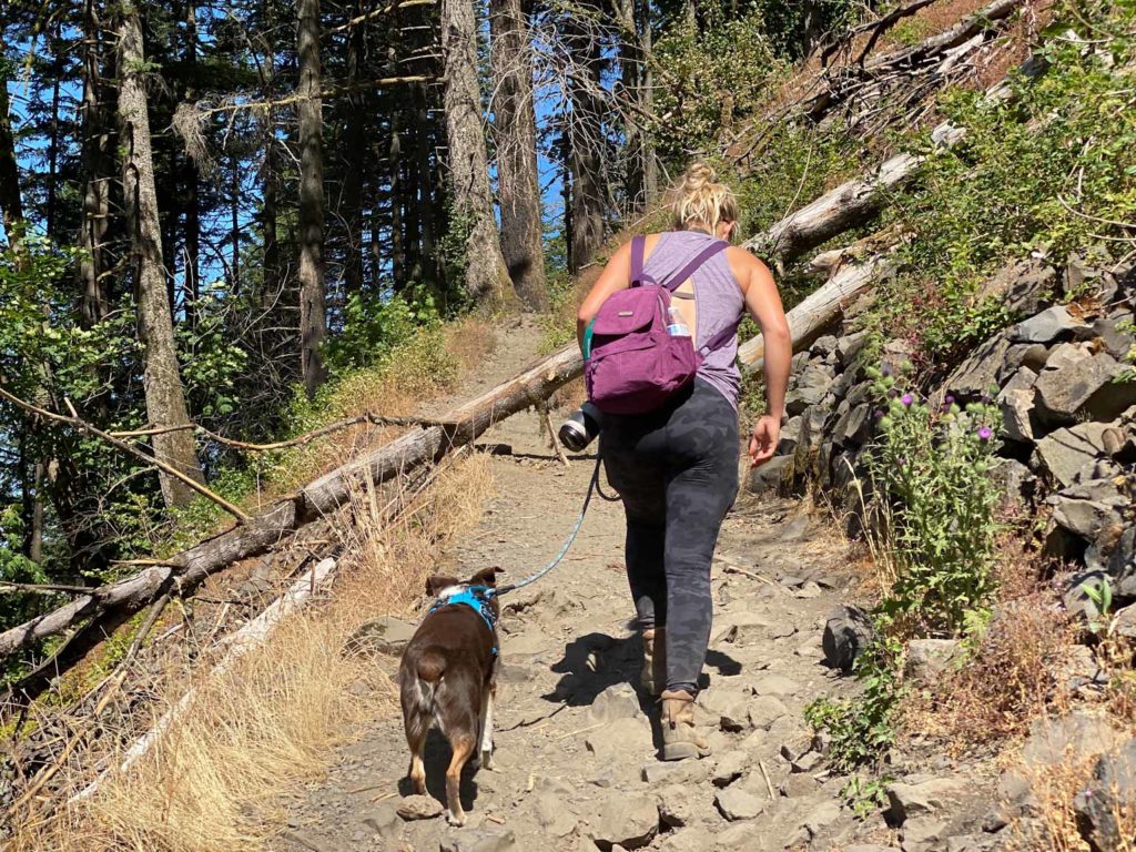
Surviving what was undoubtedly the most harrowing part of the experience, we continued onward and upward. Reaching a switchback where the junction with Gorge Trail #400 heads east, we immediately turned west and were temporarily blinded by the setting sun as we continued heading skyward on a steep and narrow trail.
While you’re fighting your way upward, take some time to look around. The Columbia River is a stunning sight to behold from this elevation and the views only get better as the path continues to rise.
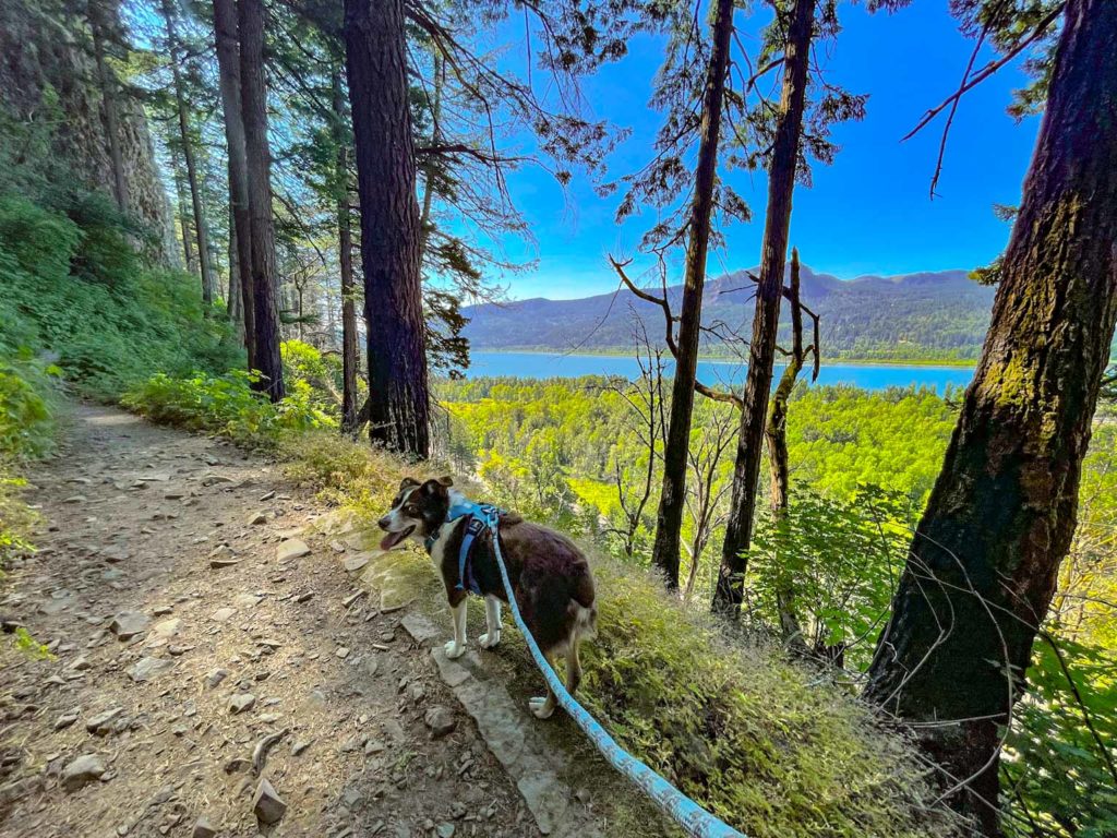
It’s also a wise idea to take a break or two for your own physical health as the continuous upward path of the trail can be quite a grind. Just don’t pause for too long. We passed some young men who stopped for a rest and never saw them again. Presumably, they didn’t make it to Ponytail Falls.
We had trekked probably less than quarter of a mile when the woodland intervened, surrounding us with curious trees all bowing downward to offer shade to the newest interlopers. It was a welcome relief from the heat of the day, providing a cooling guidance that propelled us on our way, always moving upward.
Just as we were beginning to question whether the length of the trail as indicated on the sign could be correct, the path began to level out. For some reason, upward trails always seem longer than they should, and the journey to Ponytail Falls was no exception.
Reveling in cliffside vistas of the gorge, we made the rest of the hike to Ponytail in shaded splendor, catching the sound now and again of water rushing over rock.
Eventually, we caught sight of Ponytail Falls. From the first glimpse, you don’t realize how close to the falls the trail will travel, so you’ll probably be inclined to spend a bit of time snapping photos.
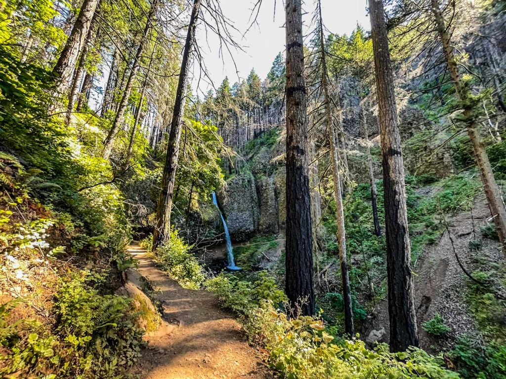
As the trail continues, you’ll quickly realize that this hike is one that gets you up close and personal with the star of the show. In this case, the trail leads directly behind the Ponytail Falls cascade into a cavern-like alcove that offers not just a view of the falls from the back, but a view of the gorge through the trees surrounding the downside stream.
For the most part, we had the Ponytail Falls cavern to ourselves, so we made the most of it, exploring the base of the falls, before making the momentous decision to travel onward. We’d heard that a rockslide had closed the trail beyond the falls but being the always curious travelers, we had to see for ourselves.
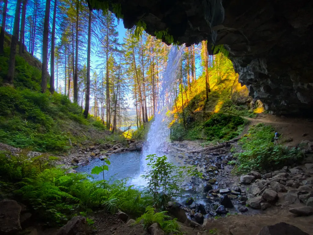
Even though the light was beginning to fade on the day, we still felt we could make the tour with time to spare. If this sounds brave for two hikers alone on the trail, keep reading to see just how brave or foolhardy we really are.
Horsetail Falls Oregon Loop Hike
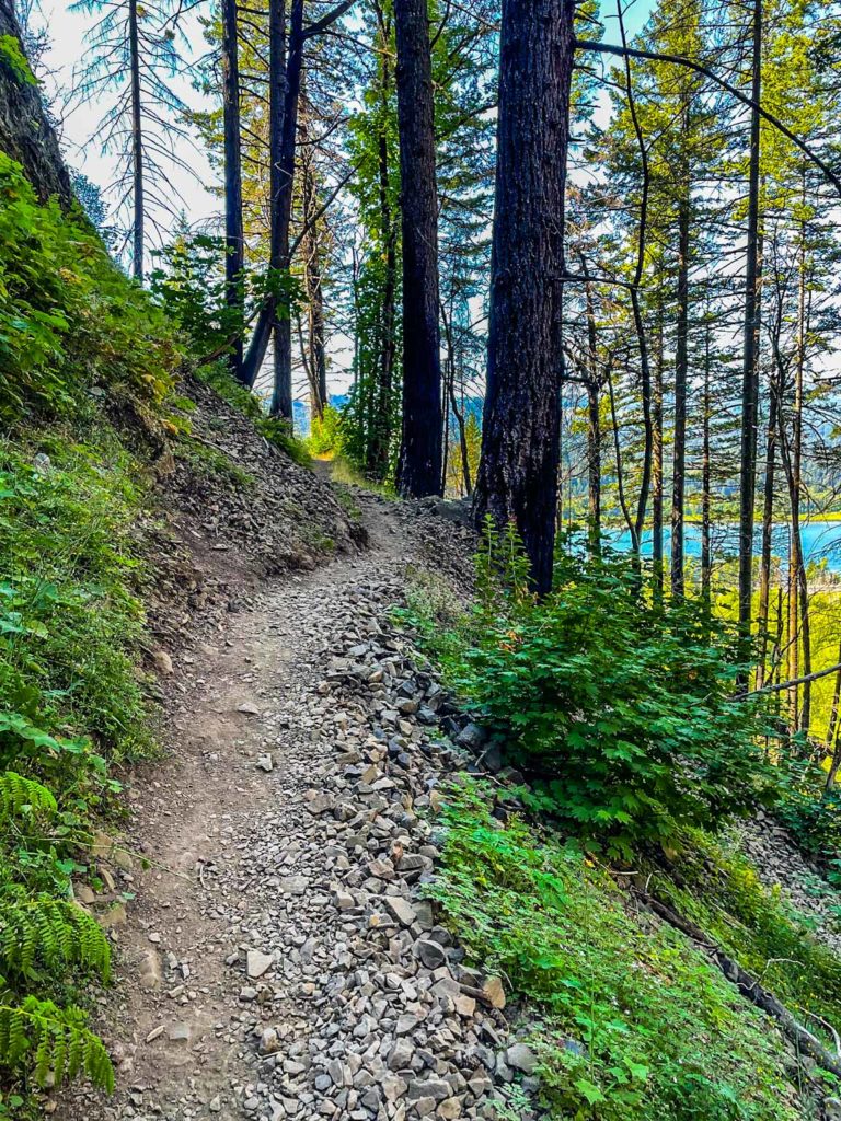
From the base of Ponytail Falls, the trail strikes out through the remains of the Eagle Creek Wildfire. Charred trees and wounded stumps surround the trail, opening up the skyline and the vista to the Gorge below.
While wildfires are never a good thing and are certainly not events we’d welcome, the results on the ridge beyond Ponytail are pretty spectacular. As regrowth emerges, the green of Oregon combines with the fading blacks and browns of the fire’s devastation as a sign of rebirth following nature’s fury.
We didn’t travel far without a view of the river beyond. It also wasn’t long before we hit a switchback, taking us higher in elevation and to the remains of the 2021 spring rockslide. It had been cleaned up nicely, but the trail remained rocky and a bit treacherous, prone to sliding.
We made it through and came out to a flat plateau, creating a treelined vista of the gorge below. A single marker lies in memorial to a fallen hiker and acts as a reminder to the rest of us not to get too close to the ridge. Remember that rockslide we just traversed? Thanks to the previous wildfire, terrain here is delicate and easily disturbed, so it’s best to stay on the trail.
Our goal was to follow the remains of the Ponytail Falls Trail to the intersection with the Oneonta Trail and seek out Lower Oneonta Falls. A couple coming toward us confirmed that the trail was indeed open that far.
Rumor has it that the path continues to an area that offers a glimpse into the narrow slot of the Oneonta Gorge. Since this Columbia River marvel has been closed since the Eagle Creek Wildfire in 2017, we were anxious to see what we could.
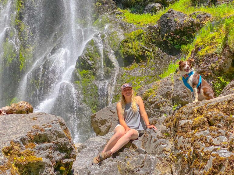
However, the closure of the 2021 spring rockslide had created something unexpected. Without foot traffic on this part of the trail, weeds and small trees or shrubs had grown in proliferous fashion, nearly blocking the trail in spots and creating a winding forest with little visibility. With no way to see what was coming ahead, no visibility behind and a trail hardy dog that was growing increasingly nervous about something we couldn’t see, we made the choice to turn around.
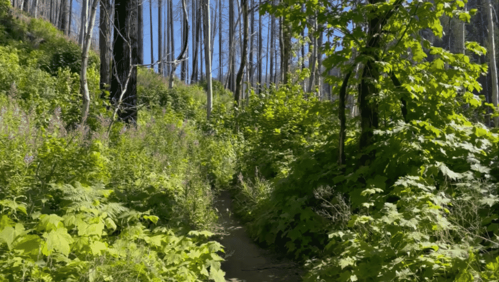
I feel it’s always wise to trust your instincts in situations like these, especially when they’re backed up by canine senses, but was disappointed to miss the remaining falls on the trail. Had we continued, we could have met up with Lower Oneonta Falls and returned the way we came or picked up the Oneonta Trail to create a loop back out to the Columbia River Highway. A short jaunt down the road would have led back to the parking area.
Back to the Base of Horsetail Falls
From the point of turnaround, we made our way back to Ponytail Falls and enjoyed the views coming from the opposite direction. We marveled again at how much quicker a hike seems on the return and were quickly back at the base of Horsetail Falls.
By this point it was around 7:00 pm on a late July day, and much of the crowds had thinned out. We took advantage of the moment to cool our feet at the base of Horsetail Falls and enjoy the sound of falling water.
If you’re traveling the Columbia River Highway, stopping at Horsetail Falls in Oregon is a must, but for the true adventurer and those wanting a more solitary experience, take the Horsetail Falls loop trail. We plan to do it again in the near future, maybe extending our time to pick up some of the other nearby falls.
