fbpx

Starvation Creek State Park: Cabin Creek Falls and Starvation Creek Falls

DISCLAIMER: Our posts may contain affiliate links. If you click through and make a purchase, we may receive commission. You won't pay more, but you will be providing us with a small commission, which helps to keep the lights on. All recommendations are based on our own opinions and preferences. You can read our complete disclaimer here. Thanks!

Starvation Creek State Park is a state park in Oregon located along the Columbia River Gorge. This trailhead serves as a jumping off point for accessing the paved old highway 30, that is now a hiking trail for pedestrians.

This trailhead also serves as easy access for four different and unique waterfalls, that are all a short walk from the trailhead.

Starvation Creek Oregon History

Highway 30 was the first highway to stretch along the Columbia River Gorge, connecting Portland to points west as far as the Dalles. It opened new travel destinations for those living along the highway and gave access to diverse natural areas that had barely been seen before.

Highway 30 wound its way through cliffs, hills, and trees, loosely following the river’s path. But, it was far from efficient. The highway was narrow and windy, making travel slow. It also made larger vehicle travel near impossible.

Soon, Highway 84 was built, mimicking the course of the river exactly and removing many of the twists, turns, and ascents and descents. The new highway had more and wider lanes, facilitating more truck traffic as overland transport of goods became more common.
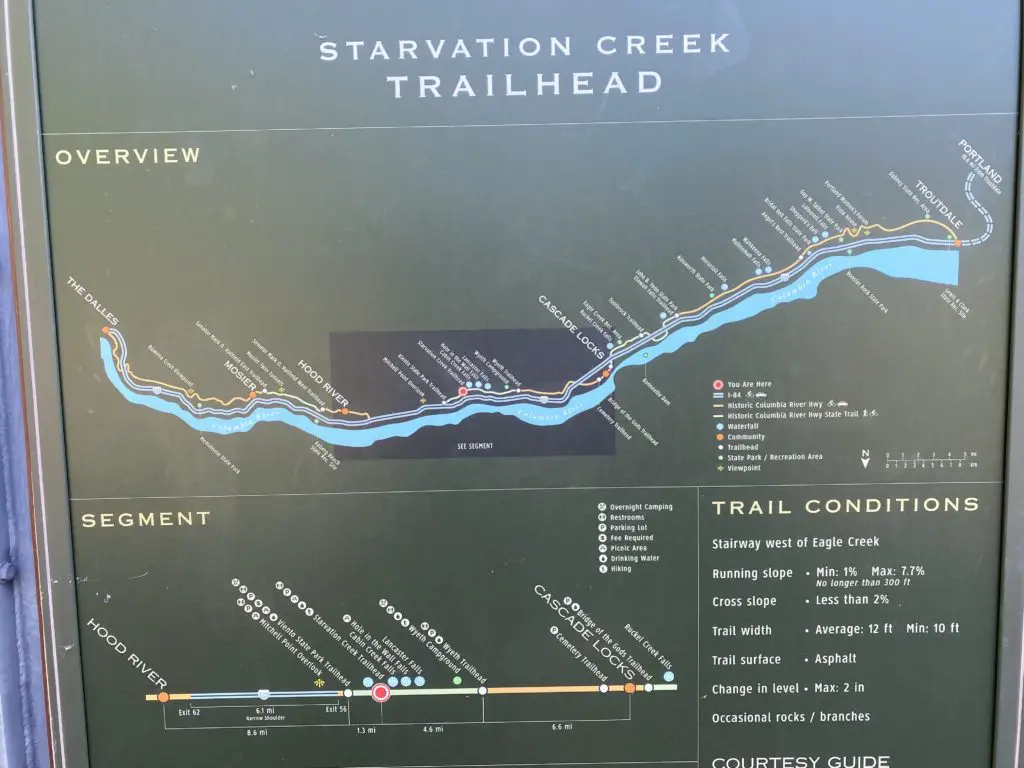
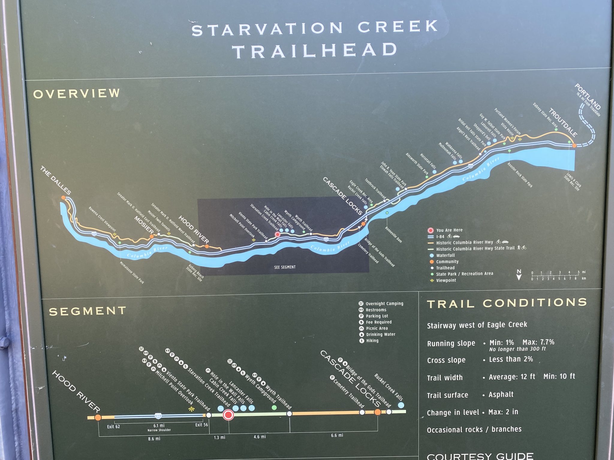
Starvation Creek State Park map
  • Save

This left Highway 30 abandoned, with many stretches falling in disrepair. In more recent years, these old stretches of the highway have been restored and turned into walking and biking paths for outdoor enthusiasts. For the first time in decades, many forgotten waterfalls, and other natural sights are once again accessible for the public to enjoy.

This is how the Starvation Creek State Park and the Starvation Creek Trail came to be. Starvation Falls, Cabin Creek Falls, Hole-in-the-Wall Falls, and Lancaster Falls are now as easily accessed by the public, as they were during the historic highway days.

What You’ll Find at Starvation Creek State Park Today

Starvation Creek State Park first and foremost, gives access to Starvation Creek Falls. The falls were named for an unfortunate incident. In December 1884, a train became stuck near the falls due to an immense snow load.

Passengers were stranded for three weeks, and almost starved. But luckily, residents of the Columbia River Gorge skied back and forth from the train delivering supplies as they could, and no one perished.
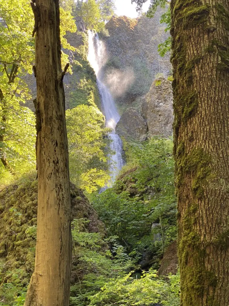
Starvation Creek State Park Falls
  • Save
Starvation Creek Falls

Today, to access the Starvation Creek Trail, just take exit 55 off of Interstate 84 and follow signs to Starvation Creek State Park. Pull into the parking lot and head to the left, behind the bathrooms. This will take you east on the Historic Columbia River Highway. Not even a tenth of a mile from the trailhead, Starvation Creek Falls will be on your right.

Be aware that there is a shaded loop walking path below the restrooms. This path will not take you to the falls. To access the falls, follow the path leading up and away from the restrooms.

At the falls, enjoy the views, take photos, or even bring a lunch to eat at one of the many picnic tables at the base.

Heading Out on the Starvation Creek Trail

Once you’ve sufficiently explored Starvation Creek Falls, its time to explore the rest of Starvation Creek State Park. Following old Highway 30 east, back track first to the parking lot, then continue west or to the left.
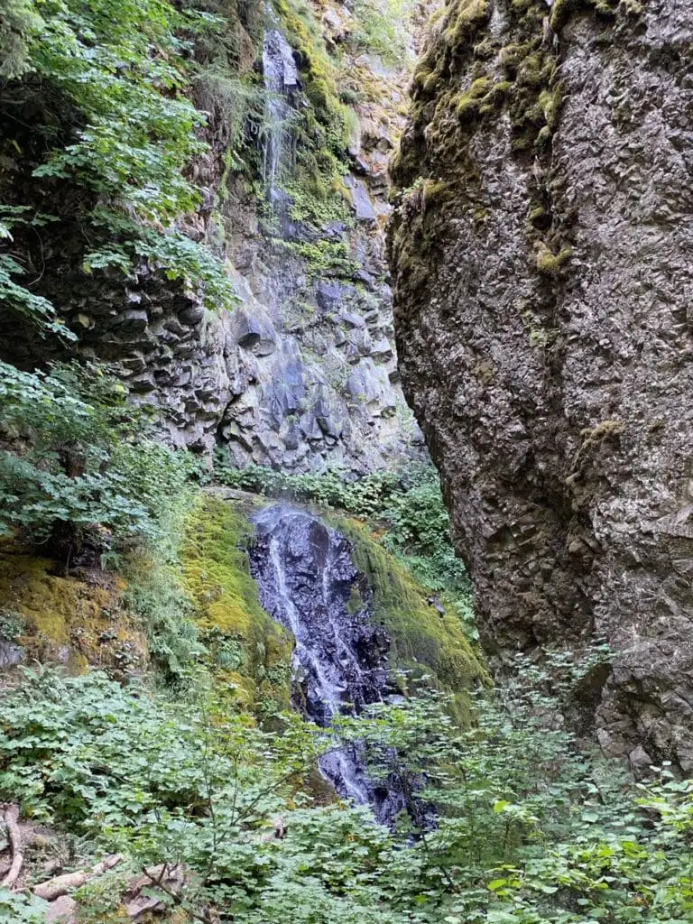
Cabin Creek Falls inside the Starvation Creek State Park
  • Save
Cabin Creek Falls

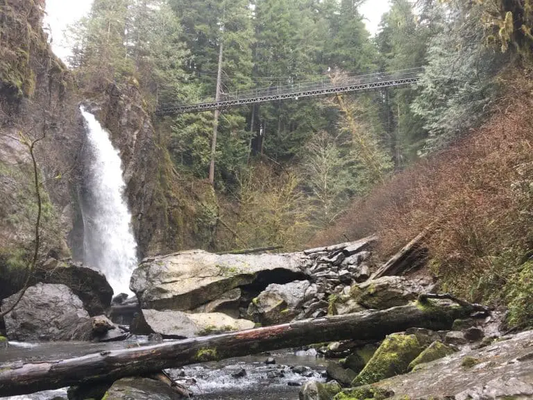
From this point, you can access three more waterfalls on the Starvation Creek Trail. First up, will be Cabin Creek Falls. The trail will lead through the parking lot and follow along Highway 84 for a bit. Soon, you will enter the trees, and the road noise will lessen.

Once you are inside the trees, keep an eye out to the left for a small brown sign that points out Cabin Creek Falls. This will be about 3/10 of a mile from the parking lot. The falls are a very short distance off the trail, so they are easy to spot.

Cabin Creek Falls contains one of the most unique natural elements inside the Starvation Creek State Park. If you opt to walk closer, you will notice the bottom of the falls bouncing around a large boulder. This large boulder fell at some point in time to create a natural amphitheater. Inside, the noise of the falls is the only thing you can hear, even if you might get a bit wet doing it.

Next up, is Hole-in-the-Wall Falls. This Falls is set 7/10 of a mile from the Starvation Creek State Park parking lot.
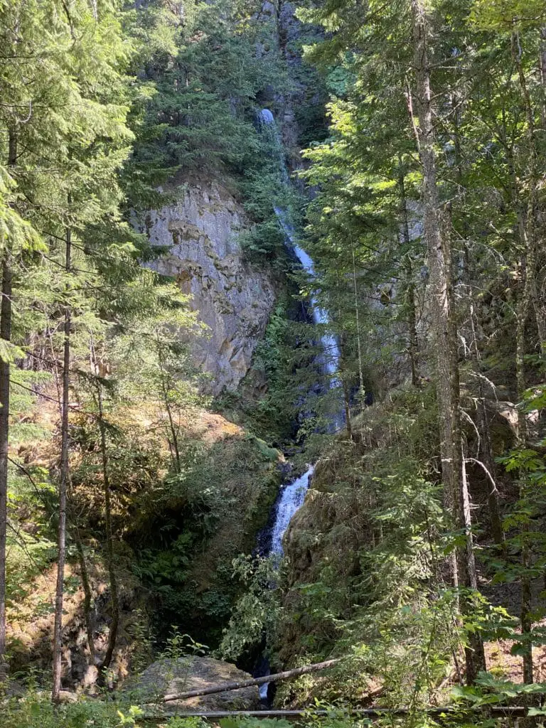
Hole-in-the-Wall Falls
  • Save
Hole-in-the-Wall Falls

6/10 of a mile from the parking lot, the trail will split in two, this is the first fork you will encounter. You will want to head to the left, then continue onward. This trail will lead directly to the falls on your left.

Hole-in-the-Wall Falls is a manmade waterfall. In the early days of the old Columbia River Highway, Warren Creek was causing erosion issues. Crews did the laborious task of rerouting the water and drilling a tunnel through tough rock.

Today, the water seems to come directly out of the stone and fall to the ground, creating the waterfall.

If you continue on over the bridge and walk for 2/10 of a mile, you will find Lancaster Falls off to your left. This section of trail does have a modest incline and is the only part of the hike so far where you will encounter much of a variation in terrain.

After visiting the four waterfalls of Starvation Creek State Park, you can return back to the parking lot, or keep the adventure going on many of the trails that criss-cross this area.

Hiking from Starvation Creek State Park

For more or longer adventures inside the Starvation Creek State Park, you can always hike more sections of the old highway 30. For example, rather than turning left to go to Hole-in-the-Wall falls, continue straight.

This will lead to the Warren Creek Bridge, which mimics the style of the old bridges on the original highway. Continuing this way will also lead to great views of Dog Mountain, Lindsey Creek, Camp Benson Falls, Lindsey Creek Falls, and Lindsey Creek State Park.

In this direction, 4.6 miles from the Starvation Creek State Park parking lot, you can even access Wyeth Campground.

Heading east from Starvation Creek Falls, hike one mile along the old Highway 30 to end at Viento State Park.

Other Trips You May Enjoy

  • Save

Ali Patton

Ali is a travel blogger for Seconds to Go, where she shares her experiences traveling the U.S. with her co-blogger Mom, Kathleen. She is also an avid Disney travel enthusiast, and with multiple Disney World trips under her belt, is a knoweldgeable resource for all things related to Disney vacations. Ali can be found managing the Seconds to Go social media accounts as well as the famed Double Z Farm pages on Instagram, Facebook and TikTok.

Thanks for Joining Our Adventure

Kathleen Hesketh and Ali Patton, mother daughter travel bloggers

We're Kat and Ali, a pair of mother-daughter travel bloggers exploring the U.S. We're sharing our experiences, tips and insights to help you more easily get out and explore the beautiful landscapes and places of this nation.

FOLLOW US

pinterest icon
Instagram icon
Facebook icon
Twitter
follow us in feedly

#Seconds2go

More Adventures

The Spruce Goose at the Air Musuem in McMinnville
  • Save

Air Museum in McMinnville Oregon Features Legendary One-Flight Plane

April 12, 2024

Share via: 1.6K Shares Pinterest 324 Facebook 1.3K Twitter 0 Reddit 0 Mix 0 Flipboard 0 LinkedIn 0 Email 0 Pocket 0 Tumblr 0 The Air Museum in McMinnville Oregon, called the Evergreen Aviation & Space Museum, offers an up close and personal view of planes and space equipment. This museum is perfect for any … Read more

Mother-daughter travel blogger team enjoying an Oregon hiking trail through old growth forest
  • Save

16 of the Best Oregon Hiking Trails for a Lifetime of Adventures

March 25, 2024

Share via: 12 Shares Pinterest 12 Facebook 0 Twitter 0 Reddit 0 Mix 0 Flipboard 0 LinkedIn 0 Email 0 Pocket 0 Tumblr 0 While we aren’t even close to covering every trail, Oregon hiking is one of our favorite activities. As a result, we’ve logged some foot miles and have done some extensive research … Read more

Lighthouse on rocky New England coast
  • Save

Visiting New England: Travel Doesn’t Get Much Better

March 23, 2024

Share via: 222 Shares Pinterest 193 Facebook 29 Twitter 0 Reddit 0 Mix 0 Flipboard 0 LinkedIn 0 Email 0 Pocket 0 Tumblr 0 New England travel bloggers are a rare breed. We don’t jet of to exotic locations and rhapsodize about far-off places. Instead, we write about a little-known piece of the U.S. that … Read more

94dbf4833d79471baa3f19d3ebd6a97c
  • Save

21 Things to Do in the Oregon Outdoors This Year

March 20, 2024

Share via: 320 Shares Pinterest 320 Facebook 0 Twitter 0 Reddit 0 Mix 0 Flipboard 0 LinkedIn 0 Email 0 Pocket 0 Tumblr 0 Whether you’re visiting Oregon for the first time or are a long time resident, exploring the Oregon outdoors should be on your bucket list. Oregon offers over 98,000 square miles of … Read more

View from road to Bohemia Mine
  • Save

Oregon Travel Guide: Must-See Vacation Places and Things to Do in the Beaver State

March 20, 2024

Share via: 2.9K Shares Pinterest 320 Facebook 2.5K Twitter 0 Reddit 0 Mix 0 Flipboard 0 LinkedIn 0 Email 0 Pocket 0 Tumblr 0 With 98,000 square miles to explore, and a diverse set of geographical areas, you’ll need an Oregon travel guide to help you find the best Oregon vacation places. So, if you’re … Read more

IMG 4626
  • Save

10 Mind-Blowing Oregon Photography Locations All Photographers Need to Visit

March 20, 2024

Share via: 285 Shares Pinterest 250 Facebook 35 Twitter 0 Reddit 0 Mix 0 Flipboard 0 LinkedIn 0 Email 0 Pocket 0 Tumblr 0 Oregon is known for its diverse landscapes and beautiful views, making it a great destination for travel photographers. Whether you are looking for a place to take frame worthy landscape shots … Read more

IMG 0048
  • Save

Visiting Oregon: Tips for Planning the Perfect Trip

March 18, 2024

Share via: 56 Shares Pinterest 10 Facebook 46 Twitter 0 Reddit 0 Mix 0 Flipboard 0 LinkedIn 0 Email 0 Pocket 0 Tumblr 0 When planning a trip to Oregon, what you see online may not be what you get. Endless natural beauty, hikes through many unique geological areas, great food, and much more make … Read more

A small boat rests quietly on the surface of Crater Lake, a top Oregon vacation spot
  • Save

Oregon Visitors Guide: The 9 Things You Must Know Before Heading to the State

March 18, 2024

Share via: 1.8K Shares Pinterest 537 Facebook 1.2K Twitter 0 Reddit 0 Mix 0 Flipboard 0 LinkedIn 0 Email 0 Pocket 0 Tumblr 0 Before you embark on an Oregon vacation, it’s important to know that the state covers over 98,000 square miles of terrain but has only two interstate highways. That leaves a lot … Read more

Oregon coast in March
  • Save

Why Visit Oregon in March? The Things You Couldn’t Stand to Miss

March 18, 2024

Share via: 79 Shares Pinterest 75 Facebook 0 Twitter 0 Reddit 0 Mix 1 Flipboard 1 LinkedIn 0 Email 2 Pocket 0 Tumblr 0 Clearing skies and warmer temperatures are only a few of the reasons you might want to visit Oregon in March. Add the possibility of early wildflowers, fewer crowds at popular spots … Read more

Travel gadget feature
  • Save

Best Travel Gadgets and Accessories for Tackling the Open Road

March 18, 2024

Share via: 1.5K Shares Pinterest 184 Facebook 1.3K Twitter 0 Reddit 0 Mix 0 Flipboard 0 LinkedIn 0 Email 0 Pocket 0 Tumblr 0 As a mother daughter travel blogger team, we’ve learned the rule of the road: be prepared for nearly every contingency. As a result, we’ve compiled a list of must-have travel gadgets … Read more