You don’t have to search long to come up with dozens of Connecticut hiking trails, but narrowing in on the best hikes in Connecticut often requires a little determination. Many are short, flat jaunts with little to pique your curiosity, while others dig deep into history or the ecological wonders of the state. These are the types of experiences that enrich us, so we’ve put together this list of some of the best day hikes in CT, focusing on those that reveal a small secret part of the state.
Table of Contents
Mine Hill Preserve-Hidden Mines and Granite Quarries Make for One of the Best Hikes in Connecticut
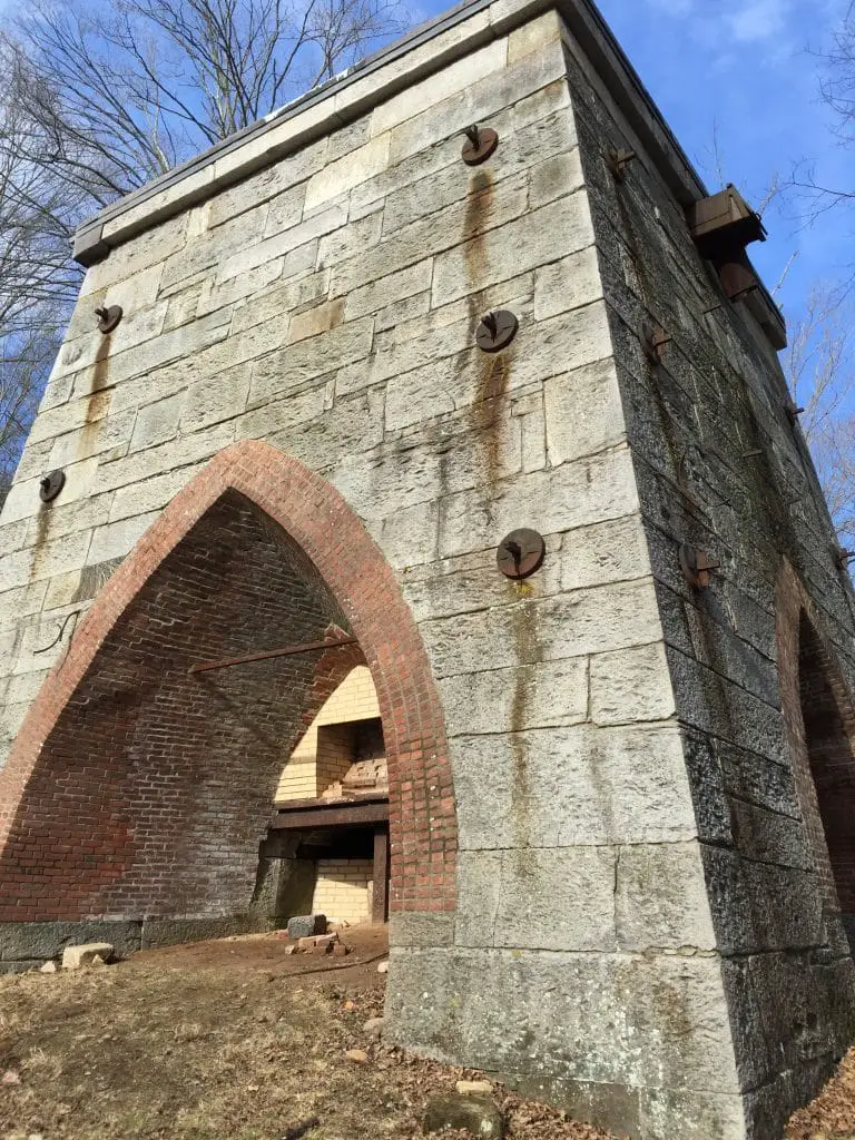
Obscurely located off Route 67 in Roxbury, Mine Hill Preserve is a delight for any history lover among us. Covering over 360 acres, it’s also one of the best day hikes in Connecticut.
The main loop trail begins off of Mine Hill Road and climbs up the Donkey trail past an abandoned mine shaft. Before you get there, however, you’ll want to spend some time exploring the blast furnaces and roasting ovens. Interpretive signs explain the history of iron making at the site, a once prosperous operation overlooking the former boom town below.
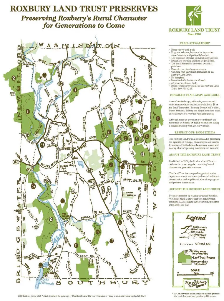
Leaving the ovens and furnace, you’ll head up the Donkey Trail, aptly named for the animals who once had the laborious chore of pulling carts of ore up iron railways from the mines. This 3.5-mile loop leads deep into the wilderness, past abandoned foundations and sealed up, but visible, mine shafts.
As iron making turned not-so-prosperous around 1872, miners came above ground and began to quarry granite from the hills. The Donkey Trail takes a meander through parts of the quarry operation before descending along the Shepaug River to end back at the blasting ovens.
Why we chose Roxbury Mines as one of the best Connecticut hiking trails:
- Historical markers provide additional detail
- Peek inside a mine shaft
- Chance to explore Connecticut history
Heublein Tower Hike in Connecticut

While we’re on the trail of Connecticut history, why not make a stop in Simsbury for a view of the Farmington Valley and a tale of a love-inspired German Castle.
Driving Route 10/202, Heublein Tower is a stunning surprise on the Talcott Mountain range. Jutting 165 feet high above the traprock ledge, it’s German inspired origins seem slightly out of place in the Connecticut countryside, which only makes it all the more intriguing.
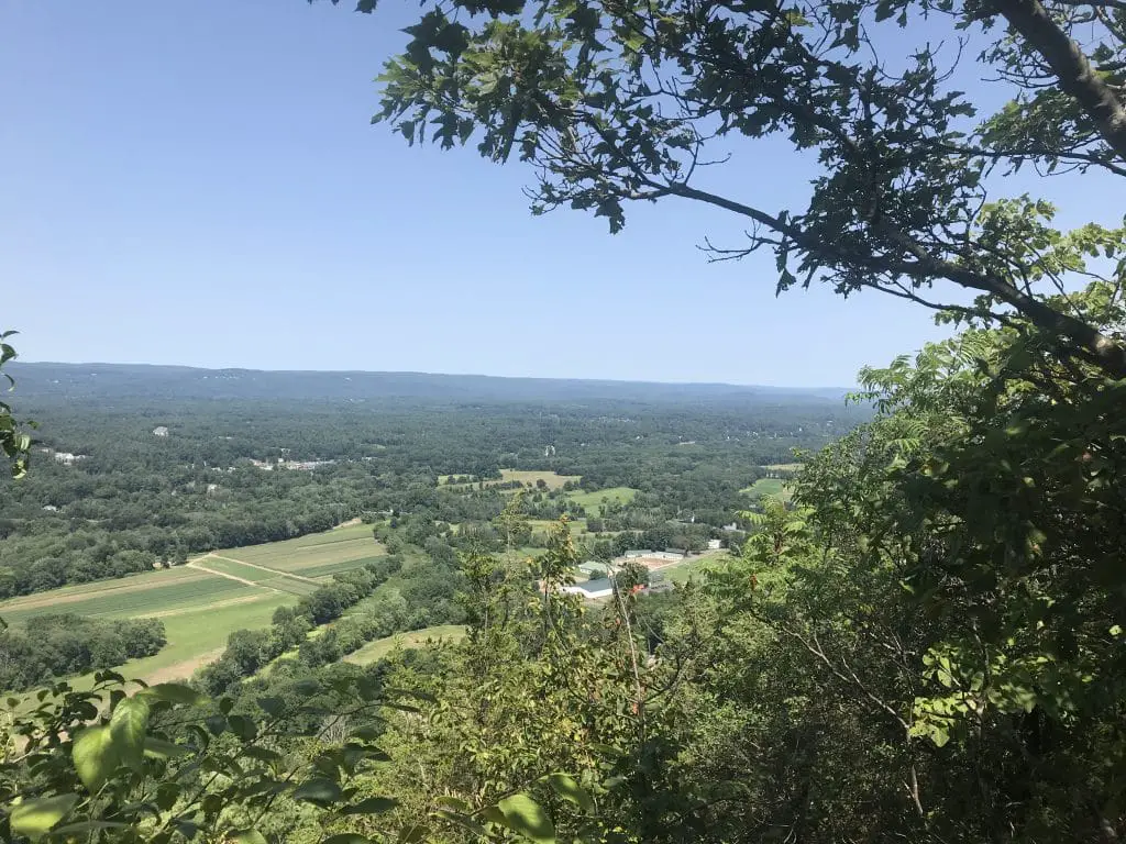
To take the Heublein Tower hike, however, you’ll have to leave the car and embark on the 1.25 mile trail leading from the parking base to the top of the ridge. It’s a punishing climb for the first quarter mile or so, but flattens out nicely once you reach the precipice, where a nice plateau provides views of the valley below. However, the best view is found at the top of the tower, about another mile down the trail.
Heublein Tower was built by Gilbert Heublein, heir to the A-1 Steak Sauce empire, to honor his wife, Louise. It was used primarily as a summer home until Gilbert’s death in 1937. The tower is open for self-touring most Thursdays through Sunday, May through the middle of November, and offers views as far as New York State, making it one of the best day hikes in CT for stunning views.
Why we chose this trail as one of the best hikes in Connecticut:
- Magnificent views
- Heublein Tower tours exploring Connecticut history
A Ghostly Encounter on One of the Best Hikes in Connecticut
The Pilfershire Trail leads out of the McClean Game Refuge on the Granby/Simsbury line in Connecticut and into an abandoned colonial town. Of course, you’ll have to climb the Garret Stairs first, a bumpy roadway on the major stagecoach route through this area of the state, and find a way to cross the stream where the old wagon bridge has washed away.
It’s a Connecticut hike that is well worth the trouble when you stumble upon the old stone walls surrounding an empty square and the ancient foundations and cellar holes that speak to a once prosperous habitation. Considering the fact that no one really knows what happened to the town of Pilfershire or its many residents, it’s all too easy to hear the ghostly echoes of their voices and imagine that you aren’t alone.
Tales of ghostly apparitions have been reported, and though we can’t attest to any sightings, there is a feeling in the air when visiting the ridge. It’s like our colonial ancestors are still watching over the town.
The trail picks up from a private driveway off of Firetown Road, passes a waterfall and continues upward until you reach the river. A water crossing is required, but it’s easy to stone hop across the stream in the summer months, as long as it hasn’t rained recently. The Westledge Trail is one of the best day hikes in Connecticut for those who love history and finding unusual surprises.
Why we chose this trail as one of the best Connecticut hiking trails:
- Ruins of an abandoned colonial town
- Hike along the Garret Stairs, an old stagecoach route
- Waterfall

Staying Skinny on the Chatfield Trail
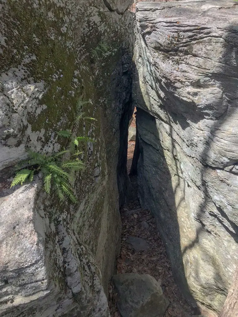
Covering a total length of 4.5 miles, the Chatfield trail in Killingworth could easily make a good day hike in CT. The trail begins off of lonely Paper Mill Road, before you reach the scout camp at the end. It flirts with rocky slopes and a determined stream, before brushing the edge of the camp for a stretch.
Eventually, solitude returns as the trail angles upward toward a rocky cairn. From the base, it looks like a bad collision of dominoes, but a climb to the top reveals a hollow cavern and the Fat Man Squeeze, a narrow rocky ravine that requires a sideways entrance into the cavern.
After the rock scramble, you’ll continue through the Cockaponset Forest and into the eerily guarded Forster Pond State Park. Part of the former estate of famed architect, Frank Forster, and part of the Connecticut State Park system, the mansion and corresponding lake now sit abandoned and largely guarded from visitors.
The closest you’ll get is a spur trail that leads to the remnants of the power mill. As you reach the end of the trail at Route 80, across from Chatfield State Park, you’ll encounter no trespassing signs warning you away from this publicly owned parcel of land. From this point, the trail then skirts around the edges of the mansion property, looping back to the earlier portion of the trail not far from Fatman’s Squeeze.
The Chatfield Trail offers an interesting hiking experience with unusual geological formations and a chance to toy with the forbidden as you skirt the edges of Forster State Park, putting it on our list of best hikes in Connecticut.
Why we chose this trail as one of the best hikes in Connecticut:
- Interesting geology
- Kids and adults alike will have fun exploring the rocks and crevices
Best Hikes in Connecticut: A Meeting of the Minds at the Indian Council Caves
One of the best hiking trails we’ve discovered in Connecticut is the Indian Council Caves trail off of Route 219 in Barkhamsted. Coming in at over 4 miles, it’s one of the longer trails on our list, but well worth it if you’re seeking solitude with nature.
The caves at the end of the trail aren’t really caves in the true sense, more rock outcroppings with intriguing depressions, but the nooks and crannies provide a fun exploration on a warm day.
Indian Council Caves lie along the Tunxis trail, so it is possible to continue further past this area for a longer Connecticut day hike. The Tunxis Trail is part of Connecticut’s blue-blazed system running from Southington to the Massachusetts border. This section of the trail features a bog, white birch forests, a glimpse of a wolf tree, and the foundation of an abandoned home.
You’ll find parking in a small area along Route 219 just west of the intersection with Hillcrest Drive.
Why we chose this trail as one of the best hikes in Connecticut:
- Peaceful solitary journey
- Foundation ruins
- Cave like formations

A Trail for Abandoned Enthusiasts
Steep Rock Preserve in Washington Depot has it all if you’re looking for a Connecticut hiking trail with some interesting adventure. Picking up the Tunnel Road trailhead just off of Lower Church Hill Road, you’ll begin with a nice warm up stroll on flat ground along the Shepaug River. This won’t last long, however, before rocks begin to intercede.
Soon, you’re climbing up and over formations as you cling to the river’s course. We took on this excursion towed by an overly excited Golden Retriever and found it a challenge but manageable. Other hikers of vary skill levels were also enjoying the trail.
The rock scramble eventually leads back to the river’s edge before wandering into the forest on relatively flat land. You’ll meet the river another time as the trail crosses a wooden suspension bridge.
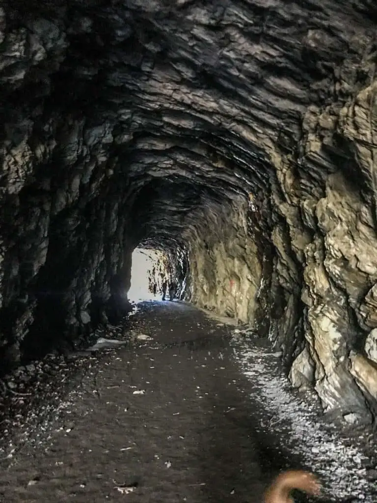
From there, A nice wander through flat woodland will eventually bring you to the abandoned train tunnel, once part of the Shepaug Valley Railroad and a line that ceased operating in 1948.
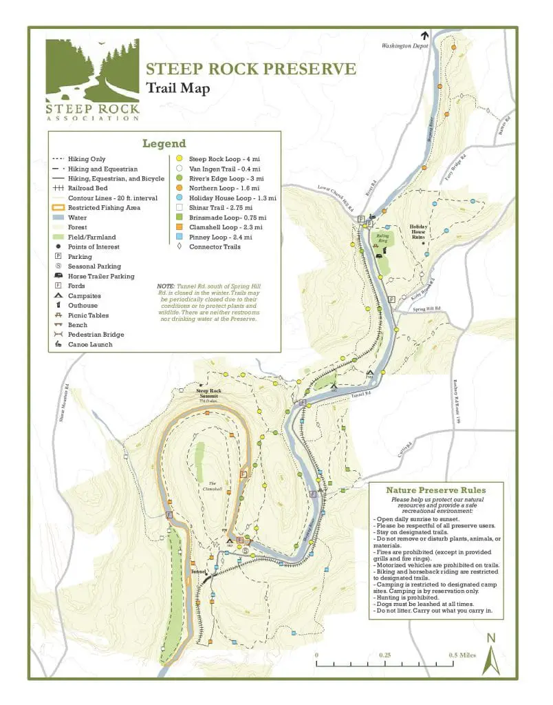
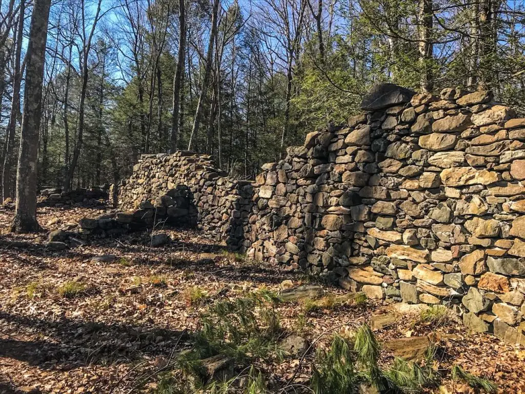
A separate, but equally fascinating trail, leads to the foundation ruins of Holiday House. Holiday House hotel was built by Edward Van Ingen, a wool importer, as a memorial to his daughter who died of scarlet fever. The Van Ingen’s operated the hotel as a retreat for working class girls, in conjunction with St. Bartholomew’s Church in New York City, until 1918.
Why we chose this trail as one of the best hikes in Connecticut:
- Abandoned tunnel
- Holiday House ruins
- Challenging rock formations
- Suspension bridge
Dismal Brook Wildlife Preserve: Preserving Nature’s Diversity and Connecticut’s Small-Town History
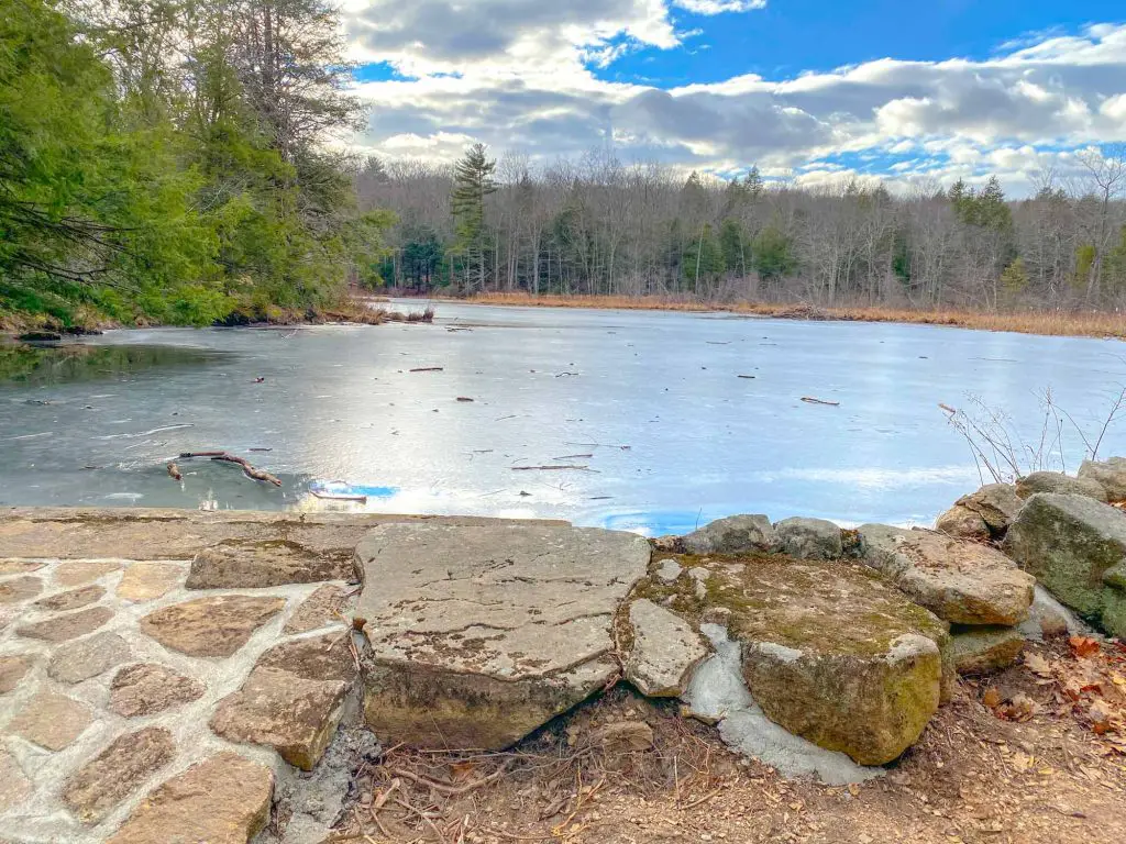
Following an abandoned road, the Dismal Brook Wildlife Preserve hike in North Granby is full of surprises. These 200 acres of prime real estate have been lovingly donated to the Granby Land Trust by James Gamble, to preserve the natural diversity of the property. To date, over 100 species of birds have been seen, including rare specimens such as the Bufflehead, American Bittern and Yellowbilled Cuckoo, among others.
But Dismal Brook Wildlife Preserve is home to more than native bird species. It is also the final resting place of some of the town’s earliest inhabitants. The Day Cemetery, located within the property, is Granby’s oldest graveyard.
Protecting 5 current graves, this small plot of land marks the final resting spot for Elijah Truman, a smallpox victim who died in 1795, as well as Nathaniel Atkinson, who died in 1861 at the very impressive age of 92. Other residents of the Day family are also interred here.
Beyond the historical significance of the property, hikers will discover an abandoned cabin overlooking Creamer Pond, a small waterfall and a dam. Dismal Brook Wildlife Preserve has received several upgrades since its inclusion as a land trust property, including a new parking lot, bird watching stations and wooden bridges to cross streams.
This newest addition to our top Connecticut hiking list is well worth the trip to this remote area of this small town, but fall and winter are likely the best seasons to visit.
To learn more about Dismal Brook Wildlife Preserve, you’ll want to read our complete hiking review.
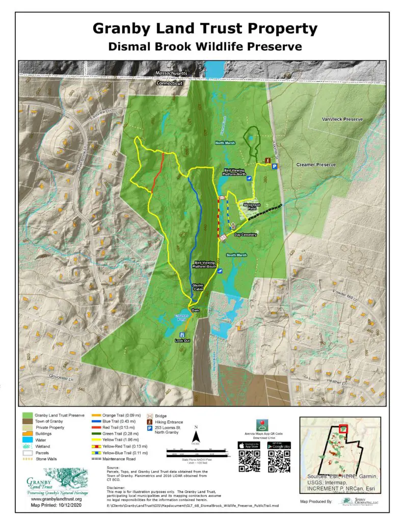
Why we chose this trail as one of the best hikes in Connecticut:
- Opportunity to walk where early settlers walked
- Historical significance
- Bird watching
Click here to download a trail map of Dismal Brook Wildlife Preserve.
EXPLORE WITH US
